Neumark

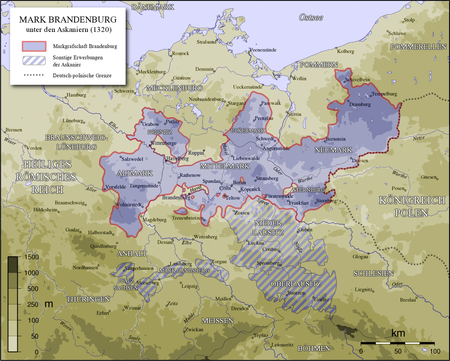
The Neumark (), also known as the New March (Polish: Nowa Marchia) or as East Brandenburg (German: ), was a region of the Margraviate of Brandenburg and its successors located east of the Oder River in territory which became part of Poland in 1945. Called the Lubusz Land while part of medieval Poland, the territory later known as the Neumark gradually became part of the German Margraviate of Brandenburg from the mid-13th century. As Brandenburg-Küstrin the Neumark formed an independent state of the Holy Roman Empire of the German Nation from 1535 to 1571; after the death of the margrave John, a younger son of Joachim I Nestor, Elector of Brandenburg, it returned to Elector John George, the margrave's nephew and Joachim I Nestor's grandson. With the rest of the Electorate of Brandenburg, it became part of the Kingdom of Prussia in 1701 and part of the German Empire in 1871 when each of those states first formed. After World War I the entirely ethnic German Neumark remained within the Free State of Prussia, itself part of the Weimar Republic (Germany). After World War II the Potsdam Conference assigned the majority of the Neumark to Polish administration, and since 1945 has remained part of Poland. Polish settlers largely replaced the expelled German population. Most of the Polish territory became part of the Lubusz Voivodeship, while the northern towns Choszczno (Arnswalde), Myślibórz (Soldin), and Chojna (Königsberg in der Neumark) belong to the West Pomeranian Voivodeship. Some territory near Cottbus, which was administratively part of the Government Region of Frankfurt (coterminous with the Neumark) after the 1815 Congress of Vienna, became part of East Germany in the 1940s, becoming part of Germany after reunification in 1990.
Excerpt from the Wikipedia article Neumark (License: CC BY-SA 3.0, Authors, Images).Neumark
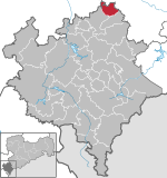
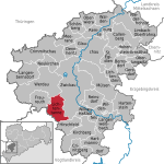
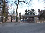
Alte Reichenbacher Straße, Neumark
Geographical coordinates (GPS) Address Nearby Places Show on map
Geographical coordinates (GPS)
| Latitude | Longitude |
|---|---|
| N 50.657222222222 ° | E 12.355277777778 ° |
Address
Alte Reichenbacher Straße 5
08496 Neumark
Saxony, Germany
Open on Google Maps


