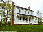
State Road, North Carolina
Surry County, North Carolina geography stubsUnincorporated communities in North CarolinaUnincorporated communities in Surry County, North CarolinaUse mdy dates from July 2023
State Road is an unincorporated community located in the Bryan Township of Surry County, North Carolina and part of Edwards III Township in eastern Wilkes County, North Carolina, United States. As of the 2000 census, the State Road postal district (28676) had a total population of 3,047.[1] The community's unique name is derived from its location on U.S. Route 21. Legend has it that when US 21 was first being built, locals constructed a horseshoe pit on the graded road surface. On Sunday afternoons when they got together to pitch horseshoes, they would say "let's go to state road" and the name stuck.
Excerpt from the Wikipedia article State Road, North Carolina (License: CC BY-SA 3.0, Authors).State Road, North Carolina
Reid Nixon Road,
Geographical coordinates (GPS) Address Nearby Places Show on map
Geographical coordinates (GPS)
| Latitude | Longitude |
|---|---|
| N 36.396388888889 ° | E -80.892222222222 ° |
Address
Reid Nixon Road
Reid Nixon Road
28683
North Carolina, United States
Open on Google Maps


