place

Tübingen West station

Buildings and structures in TübingenRailway stations in Baden-WürttembergRailway stations in Germany opened in 1910
Tübingen Westbahnhof

Tübingen West station was opened in 1910 and is located in the west of the city of Tübingen in the German state of Baden-Württemberg. It was opened in 1910 with the Ammer Valley Railway (Ammertalbahn). The station building is no longer used for railway operations. The station consists of two tracks around an island platform. It is necessary to cross over an unprotected passenger level crossing to reach the platform. Currently, the former station building houses a Tanztheater ("dance theatre") with a display space and a cocktail bar and beer garden.

Excerpt from the Wikipedia article Tübingen West station (License: CC BY-SA 3.0, Authors, Images).

Tübingen West station
Schleifmühleweg,

Geographical coordinates (GPS) Address Nearby Places
placeShow on map

Wikipedia: Tübingen West stationContinue reading on Wikipedia

Geographical coordinates (GPS)

Latitude Longitude
N 48.52 ° E 9.0385 °
placeShow on map

Address

Schleifmühleweg 97
72070 , Weststadt
Baden-Württemberg, Germany
mapOpen on Google Maps

Tübingen Westbahnhof
Share experience

Nearby Places

Tübingen
Tübingen

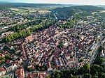
Tübingen (German: [ˈtyːbɪŋən], listen , Swabian: Dibenga) is a traditional university city in central Baden-Württemberg, Germany. It is situated 30 km (19 mi) south of the state capital, Stuttgart, and developed on both sides of the Neckar and Ammer rivers. As of 2014 about one in three of the 90,000 people living in Tübingen is a student. As of the 2018/2019 winter semester, 27,665 students attend the Eberhard Karls University of Tübingen. The city has the lowest median age in Germany, in part due to its status as a university city. As of December 31, 2015, the average age of a citizen of Tübingen is 39.1 years. The city is known for its veganism and environmentalism.Immediately north of the city lies the Schönbuch, a densely wooded nature park. The Swabian Alb mountains rise about 13 km (8 mi) (beeline Tübingen City to Roßberg - 869 m) to the southeast of Tübingen. The Ammer and Steinlach rivers are tributaries of the Neckar river, which flows in an easterly direction through the city, just south of the medieval old town. Large parts of the city are hilly, with the Schlossberg and the Österberg in the city centre and the Schnarrenberg and Herrlesberg, among others, rising immediately adjacent to the inner city. The highest point is at about 500 m (1,640.42 ft) above sea level near Bebenhausen in the Schönbuch forest, while the lowest point is 305 m (1,000.66 ft) in the city's eastern Neckar valley. The geographical centre of the state of Baden-Württemberg is in a small forest called Elysium, near the Botanical Gardens of the city's university.