Simmersberg

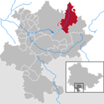
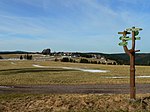
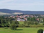
The Simmersberg is a mountain, 780.8 m above sea level (NHN), near Schnett in the municipality of Masserberg) in the county of Hildburghausen in Germany. It is the main summit of a forked mountain chain, which runs along the boundary between the Thuringian Forest and the Thuringian Highland from Masserberg towards the southwest and is bounded by the valleys of the Schleuse (in the northwest) and its tributary, the Biber (in the south). Other subpeaks of the ridge are the Hohe Warth (718 m) in the west, the Kohlberg (718 m) in the southwest, the Schnetter Berg (757 m) in the north and the Höheberg (780 m) in the northeast. The volcanic origins within the otherwise non-volcanic mountain ridge can be recognised especially well near the Simmersberg and its two 718 metre-high pre-summits. The 740-metre-high Holzberg, which is 2 km northeast and adjacent to the Schnetter Berg and north of the Höheberg, separated by a deep valley from the Simmersberg peaks, must be considered as an independent mountain.
Excerpt from the Wikipedia article Simmersberg (License: CC BY-SA 3.0, Authors, Images).Simmersberg
Am Kirchberg,
Geographical coordinates (GPS) Address Nearby Places Show on map
Geographical coordinates (GPS)
| Latitude | Longitude |
|---|---|
| N 50.5025 ° | E 10.8933 ° |
Address
Am Kirchberg 25
98666
Thuringia, Germany
Open on Google Maps


