place

Rosedale, South Australia

AC with 0 elementsTowns in South AustraliaUse Australian English from August 2019
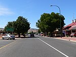
Rosedale street view

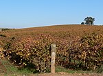
Rosedale is a small town in the south western Barossa Valley in South Australia. Prior to renaming placenames of enemy origin in 1918, Rosedale was named Rosenthal. The locality of Rosedale spans the North Para River which is the boundary between two local government areas. North of the river is in the Light Regional Council. South of it is in the Barossa Council. The Turretfield Research Centre is on the north bank of the river just outside the township.

Excerpt from the Wikipedia article Rosedale, South Australia (License: CC BY-SA 3.0, Authors, Images).

Rosedale, South Australia
Rosedale Road, Light Regional Council

Geographical coordinates (GPS) Address Nearby Places
placeShow on map

Wikipedia: Rosedale, South AustraliaContinue reading on Wikipedia

Geographical coordinates (GPS)

Latitude Longitude
N -34.55 ° E 138.85 °
placeShow on map

Address

Rosedale Road

Rosedale Road
5350 Light Regional Council (Rosedale)
South Australia, Australia
mapOpen on Google Maps

Rosedale street view
Share experience

Nearby Places

Barossa Valley (wine)

The Barossa Valley wine region is one of Australia's oldest and most premier wine regions. Located in South Australia, the Barossa Valley is about 56 km (35 miles) northeast of the city of Adelaide. Unlike most of Australia whose wine industry was heavily influenced by the British, the wine industry of the Barossa Valley was founded by German settlers fleeing persecution from the Prussian province of Silesia (in what is now Poland). The warm continental climate of the region promoted the production of very ripe grapes that was the linchpin of the early Australian fortified wine industry. As the modern Australian wine industry shifted towards red table wines (particularly those made by the prestigious Cabernet Sauvignon) in the mid-20th century, the Barossa Valley fell out of favor due to its reputation for being largely a Syrah from producers whose grapes were destined for blending. During this period the name "Barossa Valley" rarely appeared on wine labels. In the 1980s, the emergence of several boutique families specializing in old vine Shiraz wines began to capture international attention for the distinctive style of Barossa Shiraz, a full bodied red wine with rich chocolate and spice notes. This led to a renaissance in the Barossa Valley which catapulted the region to the forefront of the Australian wine industry.Many of Australia's largest and most notable wineries are either headquartered or own extensive holdings in the Barossa Valley. These include such wineries as Penfolds, Peter Lehmann, Orlando Wines, Seppeltsfield, Wolf Blass and Yalumba. Many Shiraz vines in the Barossa Valley are several decades old, with some vineyards planted with old vines that are 100–150 years old including Turkey Flat in Tanunda that is home to the oldest commercially producing grape vines, originally planted in 1847. Other grape varieties grown in the Barossa Valley include Grenache, Mourvedre, Cabernet Sauvignon, Riesling, Chardonnay and Semillon.In February 2011, South Australian Premier Mike Rann announced that special legislation would be introduced to protect the unique heritage of the Barossa Valley and McLaren Vale. Premier Rann said: "Barossa and McLaren Vale food and wine are key icons of South Australia. We must never allow the Barossa or McLaren Vale to become suburbs of Adelaide." The Character Preservation (Barossa Valley) Act 2012 was subsequently passed by the South Australian Parliament.

Sandy Creek Conservation Park

Sandy Creek Conservation Park, formerly the Sandy Creek National Park, is a protected area located in the Australian state of South Australia in the localities of Lyndoch and Sandy Creek about 42 kilometres (26 mi) north-east of the state capital of Adelaide and about 3 kilometres (1.9 mi) west-south-west of the town centre in Sandy Creek.The conservation park consists of land in sections 72, 317 and 319 and in allotments 10, 50 and 202 in the cadastral unit of the Hundred of Barossa.The land first received protected area status in respect to section 72 as a wildlife reserve under the Crown Lands Act 1929 proclaimed on 7 October 1965. On 25 May 1967, sections 317 and 319 were declared as a national park under the National Parks Act 1966 and on 9 November 1967 along with section 72 were named as the Sandy Creek National Park. On 27 April 1972, the national park was reconstituted as the Sandy Creek Conservation Park under the National Parks and Wildlife Act 1972. Since 1972, the following land from the Hundred of Barossa has been added to the conservation park - allotment 10 on 11 April 1991, allotment 50 on 8 September 1994 and allotment 202 on 19 January 2006. As of 2019, it covered an area of 1.58 square kilometres (0.61 sq mi). In 1980, the conservation park was described as follows:The topography of this park is one of gently undulating sandy hills and plains dissected by creeks, elevation ranging from 185m to 235m above sea level. The major vegetation associations at Sandy Creek consist of various combinations of Eucalyptus fasciculosa and Callitris preissii. The structural formation ranges from low woodland to open forest while the understorey is variable. Abandoned vineyards and small discrete areas of Eucalyptus leucoxylon and E. odorata also occur in the park… Lomandra multiflora which is an endangered plant in South Australia and three rare plant species… occur in the park. Macropus fuliginosus (western grey kangaroo) is present, while 120 species of birds, including five species of cuckoos have been recorded… The occurrence together of birds from both sclerophyll forests and from mallee areas is ecologically significant. The conservation park is classified as an IUCN Category III protected area. In 1980, it was listed on the now-defunct Register of the National Estate.