place

Atter (Osnabrück)

Geography of Osnabrück
Herrenhaus Gut Leye
Herrenhaus Gut Leye

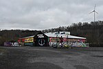
Atter is a district in the west of Osnabrück, Lower Saxony, Germany, with a population of 4,135 residents across 2,030 households (as of late 2008). Covering an area of 1,075.9 hectares, it was incorporated into the city of Osnabrück on 1 July 1972. The districts on which it borders are Eversburg (NE), Westerberg (SE), and Hellern (S). On the west it borders on the municipality of Lotte in North Rhine-Westphalia; Autobahn 1 also passes through this area. The border with Westerberg runs through the Rubbenbruchsee, a local recreation area. Atter is home to the Attersee, the Protestant Stephanuskirche and Gut Leye (the Leye estate) which has its own Roman Catholic chapel. The Reformed Protestant Atterkirche was closed down due to financial difficulties. Atter’s cemetery is the smallest in Osnabrück, covering an area of around 10,000 m². Situated in the Leyer Holz north of the district’s centre, it was originally built in 1913. The former site of the Quebec Barracks covers an area of 370,410 m². Decommissioned in 2008, it used to serve as the headquarters of the British Army in Germany (formerly the British Army of the Rhine. 107 housing units in Atter – mostly built during the 1950s and 1960s – were used by relatives of British soldiers in the area.

Excerpt from the Wikipedia article Atter (Osnabrück) (License: CC BY-SA 3.0, Authors, Images).

Atter (Osnabrück)
Winterkamp, Osnabrück

Geographical coordinates (GPS) Address Nearby Places
placeShow on map

Wikipedia: Atter (Osnabrück)Continue reading on Wikipedia

Geographical coordinates (GPS)

Latitude Longitude
N 52.2917 ° E 7.9508 °
placeShow on map

Address

Grundschule Atter

Winterkamp
49076 Osnabrück
Lower Saxony, Germany
mapOpen on Google Maps

Herrenhaus Gut Leye
Herrenhaus Gut Leye
Share experience

Nearby Places

Pye (Osnabrück district)

Pye is a district of the city of Osnabrück, Germany. Its positioning in the countryside on the outskirts of Osnabrück and its good transport connections to the city make it an appealing area for residents. Until 1972 Pye was a separate village in the district of Osnabrück. It belonged to the parish of St. Johann (St. John) in Osnabrück and was a predominantly Catholic area. Agriculture formed the backbone of the local economy. On 1 July 1972 it became a district of Osnabrück; since 1978 it has had its own parish (St. Matthias). Pye is also the location of the Piesberg (derived from "Pyes Berg" (Pye's Mountain)). Coal mining took place here during the 19th and 20th centuries. Even today, stones continue to be mined from the Piesberg quarry. The Piesberg was also the location of the largest landfill site in the Osnabrück region until June 2006. The Museum Industriekultur (Museum of Industrial Culture) is situated on the Piesberg, giving insight into the history of mining on the mountain. In Pye there is a street called "Am Pyer Ding". This is in reference to the Old German term "Thing" - meaning that Pye was also the location of such a "Thing". The countryside surrounding Pye is mostly characterised by small to medium-sized woods, grassland and a branch canal, which is an offshoot of the Mittelland Canal. The Osnabrück-Piesberg railway station is located at the edge of the district - currently it is only used for special train journeys (using steam locomotives) on event days, travelling there from the central station in Osnabrück via the Osnabrück-Altstadt station.

Hafen (Osnabrück)
Hafen (Osnabrück)

Hafen (Harbour) is a district of Osnabrück, Lower Saxony. Germany. It is located in the north-west of the city and had a population of roughly 2,358 residents in 1,454 households as of late 2008. One year earlier the city had 2,372 residents. It covers an area of 407.2 hectares.The most important aspect of the area's economy is the city harbour from which the district takes its name; primarily home to industrial estates. The harbour is connected to the Mittelland Canal by the Osnabrück branch canal (termed the “Stichkanal” or “Zweigkanal”). The construction of the harbour basin, along with the closing off of the area, began in 1912; in 1916 the first ship was berthed here, one year after the completion of the branch canal – the barge “Minden 52”, which had transported 475 tons of oats to Osnabrück, arrived on 3 April.1.28 million tons of goods were handled in the harbour area during 2004; goods transported by ship accounted for 629,000 tons of this total. In 2008 1.24 million tons were handled; there was, however, a marked decrease in 2009.The local Hafenbahn (harbour railway) is run by the Stadtwerke Osnabrück (Osnabrück Public Utilities), which also runs the harbour itself. Businesses based at the harbour include Hellmann Worldwide Logistics, founded in 1871 as a forwarding company and today active internationally. The company uses the former Speicher III (Warehouse No. III) as an office building; having been built in 1934 as a granary, it was redesigned substantially from 2008 onwards and has since won awards in its new function. Another business based around this area is the paper manufacturer Ahlstrom.Since 2007, passenger ships have once again been running along the branch canal.The Hafen district is home to a former barracks building used by the British armed forces based in Germany – the Roberts Barracks. The British armed forces took until the end of March 2009 to leave Osnabrück completely.Around Bramscher Straße there used to be a tram connection on line 2, running from Haste via Bramscher Straße, Hasetor, Nikolaiort and Neumarkt towards Schölerberg. The Osnabrück-Piesberg railway station is located in the northern part of the Hafen district; it runs special services using museum trains, which travel via Osnabrück-Altstadt towards the Hauptbahnhof (central station) on several days every year.