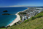
place

Tauranga Domain

1873 establishments in New ZealandParks in New ZealandRugby union stadiums in New ZealandSport in TaurangaSports venues in the Bay of Plenty Region
Urban public parksUse New Zealand English from November 2015

Tauranga Domain is a park and sports stadium in Tauranga, New Zealand. It is used mainly for rugby union matches and serves as a home ground for the Bay of Plenty Rugby Union. The origins of the park go back to 1873, when Tauranga residents applied to the Native Minister for a domain to be set aside. Five years later, the park was extended to the south. In 1881, the northern part was set aside for a secondary school. War memorial gates commemorate local men who died in World War I, and the gates are registered with Heritage New Zealand as a Category II item.The park hosted its first National Provincial Championship game in 2015. Bay of Plenty lost to the visiting Waikato team by 43-10. It also hosted host two more games in the 2016 Mitre 10 Cup. One against Taranaki and the other against Otago.

Excerpt from the Wikipedia article Tauranga Domain (License: CC BY-SA 3.0, Authors).

Tauranga Domain
Cameron Road, Tauranga Tauranga Central

Geographical coordinates (GPS) Address Nearby Places
placeShow on map

Wikipedia: Tauranga DomainContinue reading on Wikipedia

Geographical coordinates (GPS)

Latitude Longitude
N -37.679444444444 ° E 176.16527777778 °
placeShow on map

Address

Cameron Road
3110 Tauranga, Tauranga Central
Bay of Plenty, New Zealand
mapOpen on Google Maps

Share experience

Nearby Places

Tauranga
Tauranga

Tauranga (Māori pronunciation: [ˈtaʉɾaŋa]) is a coastal city in the Bay of Plenty Region and the fifth-most populous city of New Zealand, with an urban population of 161,800 (June 2023), or roughly 3% of the national population. It was settled by Māori late in the 13th century, colonised by Europeans in the early 19th century, and was constituted as a city in 1963.The city lies in the north-western corner of the Bay of Plenty, on the south-eastern edge of Tauranga Harbour. The city extends over an area of 141.91 square kilometres (54.79 sq mi), and encompasses the communities of Bethlehem, on the south-western outskirts of the city; Greerton, on the southern outskirts of the city; Matua, west of the central city overlooking Tauranga Harbour; Maungatapu; Mount Maunganui, located north of the central city across the harbour facing the Bay of Plenty; Otūmoetai; Papamoa, Tauranga's largest suburb, located in the Bay of Plenty; Tauranga City; Tauranga South; and Welcome Bay. Tauranga is one of New Zealand's main centres for business, international trade, culture, fashion and horticultural science. The Port of Tauranga is New Zealand's largest port in terms of gross export tonnage and efficiency. Tauranga is one of New Zealand's fastest-growing cities, with an 11% increase in population between the 2006 census and the 2013 census, and 19% between the 2013 and 2018 census. Due to its rapid population growth, Tauranga has become New Zealand's fifth-largest city, overtaking Dunedin and the Napier-Hastings urban areas.