Pont d'Aquitaine
Bridges completed in 1967Bridges over the GaronneBuildings and structures in BordeauxSuspension bridges in FranceTransport in Bordeaux
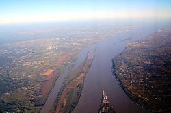
The Pont d'Aquitaine is a large suspension bridge over the Garonne, north-west of the city of Bordeaux, in France. It forms part of the ring-road of Bordeaux and carries the A630 autoroute. It was completed in 1967 and its main span is 394 m (1,293 ft) long. The eastern and western aspects of the bridge are dramatically different. To the east there is a ridge of land which allows the roadway to enter the bridge with little or no slope. By contrast, to the west there is an area of flat land, forming part of the Medoc, which means the roadway across the bridge slopes dramatically upwards in order to gain sufficient height to enter the bridge.
Excerpt from the Wikipedia article Pont d'Aquitaine (License: CC BY-SA 3.0, Authors).Pont d'Aquitaine
A 630, Bordeaux Bacalan
Geographical coordinates (GPS) Address External links Nearby Places Show on map
Geographical coordinates (GPS)
| Latitude | Longitude |
|---|---|
| N 44.879722 ° | E -0.536944 ° |
Address
Pont d'Aquitaine
A 630
33300 Bordeaux, Bacalan
Nouvelle-Aquitaine, France
Open on Google Maps


