Kellerberg (Meulenwald)
Mountains and hills of Rhineland-PalatinateMountains and hills of the Eifel
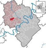
The Kellerberg is a hill, 448.8 m above sea level (NHN), and the highest point of the Eifel part of the Meulenwald and of the collective municipality of Wittlich-Land. It rises near Dierscheid in the county of Bernkastel-Wittlich in the German state of Rhineland-Palatinate. At the top is the Kellerberg Observation Tower.
Excerpt from the Wikipedia article Kellerberg (Meulenwald) (License: CC BY-SA 3.0, Authors).Kellerberg (Meulenwald)
L 49, Wittlich-Land
Geographical coordinates (GPS) Address Nearby Places Show on map
Geographical coordinates (GPS)
| Latitude | Longitude |
|---|---|
| N 49.8945 ° | E 6.760889 ° |
Address
L 49
54523 Wittlich-Land
Rhineland-Palatinate, Germany
Open on Google Maps

