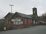
Clay Cross Urban District
Derbyshire geography stubsDistricts of England abolished by the Local Government Act 1972Districts of England created by the Local Government Act 1894History of DerbyshireUnited Kingdom government stubs ... and 1 more
Urban districts of England

Clay Cross was an Urban District in Derbyshire, England from 1894 to 1974. It was created under the Local Government Act 1894. It was enlarged in 1935 when parts of the civil parishes of Pilsley, Stretton, Tupton and Woodthorpe were transferred to the district from Chesterfield Rural District. The district was abolished in 1974 under the Local Government Act 1972 and combined with Dronfield Urban District and Chesterfield Rural District (except the civil parish of Brimington) to form the new North East Derbyshire district.
Excerpt from the Wikipedia article Clay Cross Urban District (License: CC BY-SA 3.0, Authors, Images).Clay Cross Urban District
Thanet Street, North East Derbyshire Holmgate
Geographical coordinates (GPS) Address Nearby Places Show on map
Geographical coordinates (GPS)
| Latitude | Longitude |
|---|---|
| N 53.1637 ° | E -1.4128 ° |
Address
The Fat Panda
Thanet Street
S45 9JS North East Derbyshire, Holmgate
England, United Kingdom
Open on Google Maps


