place

West Lakes, South Australia

Adelaide geography stubsSuburbs of AdelaideUse Australian English from August 2019
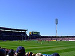
Westlakes, Western Suburbs, Adelaide panoramio

West Lakes is a suburb of Adelaide, the state capital of South Australia, Australia. It lies within the City of Charles Sturt. It contains the Westfield West Lakes Shopping Centre, Woodlake Shopping Centre and West Lakes Golf Club. It also contains Delfin Island, a residential island within the boating lake. West Lakes has an irregular shape and shares borders with Port Adelaide, Queenstown, Royal Park, Seaton, Grange, Tennyson and West Lakes Shore.

Excerpt from the Wikipedia article West Lakes, South Australia (License: CC BY-SA 3.0, Authors, Images).

West Lakes, South Australia
Lochside Drive, Adelaide West Lakes

Geographical coordinates (GPS) Address Phone number Website Nearby Places
placeShow on map

Wikipedia: West Lakes, South AustraliaContinue reading on Wikipedia

Geographical coordinates (GPS)

Latitude Longitude
N -34.87265 ° E 138.49541 °
placeShow on map

Address

West Lakes Golf Club

Lochside Drive 26
5021 Adelaide, West Lakes
South Australia, Australia
mapOpen on Google Maps

Phone number

call+61882683054;+61882683850

Website
westlakesgolfclub.com.au

linkVisit website

Westlakes, Western Suburbs, Adelaide panoramio
Share experience

Nearby Places

Tennyson, South Australia

Tennyson is a suburb in the Australian state of South Australia located in the Adelaide metropolitan area about 11 kilometres (6.8 mi) north-west of the Adelaide city centre and about 4.8 kilometres (3.0 mi) west of the municipal seat of Woodville.Tennyson consists of a strip of land on the east coast of Gulf St Vincent extending from a beach with a frontage of sand dunes in the west for a distance of about 450 metres (1,480 ft) to the west side of the artificial lake known as West Lakes in the east. It borders West Lakes for the full length of the part of the lake where a 2,000 metres (6,600 ft) rowing course is located. Its northern boundary is located just north of Estcourt Road while it is bounded in the south by Fort Street.Tennyson's boundaries were created on 30 September 1976 for land which includes the Town of Tennyson at its southern end. On 20 April 2006, the suburb's northern boundary was altered to include land from the adjoining suburb of West Lakes Shore so that suburb boundaries aligned with those of land parcels. The suburb's name is derived from the Town of Tennyson and ultimately from Hallam Tennyson, 2nd Baron Tennyson who was the Governor of South Australia from 1899 to 1902 and who was the Governor-General of Australia from 1903 to 1904. Tennyson Post Office opened on 18 September 1962 and closed in 1972.Estcourt House, the former home of Frederick Estcourt Bucknall which is listed on the South Australian Heritage Register is located at the northern end of the suburb.The 2016 Australian census which was conducted in August 2016 reports that Tennyson had 1,166 people living within its boundaries.Tennyson is located in the federal division of Hindmarsh, the state electoral district of Lee and the local government area of the City of Charles Sturt.

Tapleys Hill Road
Tapleys Hill Road

Tapleys Hill Road is a north–south arterial road in the western suburbs of Adelaide, Australia. It runs parallel to the coast between Port Road and Anzac Highway. It is designated as Route A15 which continues south of Anzac Highway as Brighton Road. Tapleys Hill Road passes through the City of Port Adelaide Enfield, City of Charles Sturt, City of West Torrens and City of Holdfast Bay. Places of interest located on Tapleys Hill Road include Royal Adelaide Golf Course, Adelaide Shores Golf Park, Harbour Town and a viewing area at the western end of Adelaide Airport. Prior to an upgrade in the 1990s, Tapleys Hill Road's southern end was joined to Anzac Highway about 100 metres to the west of where it currently lays. The upgrade involved re-aligning the roadway, and taking Tapleys Hill Road to Brighton Road's northern end, removing congestion in a busy area. The old roadway still exists, now named as Old Tapleys Hill Road, and is rarely used as a through route, servicing mainly residents of the area. Tapleys Hill Road is the northern part of Route A15 which continues past the southern end of Tapleys Hill Road onto Brighton Road, then Ocean Boulevard, Lonsdale Road and Dyson Road. Route A15 continues through Port Noarlunga on parts of Murray Road, Gawler Street, Gray Street, Saltfleet Street, Commercial Road and by Maslin Beach, Old Coach Road. Tapleys Hill (35°03′S 138°34′E) is located west of Flagstaff Road and east of Main South Road on the boundary of the suburbs of O'Halloran Hill and Flagstaff Hill, near the Victoria Hotel (colloquially "Top of Taps Hotel"). The hill was named for Thomas Tapley (1789–1856), who arrived in South Australia aboard the Rajahstan in November 1838 and took up land in that location. The hill is the source of the name for Tapleys Hill Road. The road forms the initial half of the traditional route from Port Adelaide to Tapley's Hill, the remainder of the traditional route, from Glenelg onwards, being via Diagonal Road and since-altered local roads up the hill from Darlington.