place

Big Sycamore Canyon

Canyons and gorges of CaliforniaNewbury Park, CaliforniaSanta Monica MountainsSanta Monica Mountains National Recreation Area
Mt. Boney, CA
Mt. Boney, CA

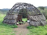
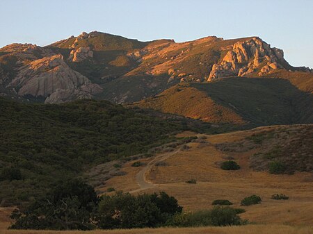
Big Sycamore Canyon, often shortened to Sycamore Canyon, is a major feature of Point Mugu State Park, in Ventura County, California, United States. Sycamore Canyon is situated in the northernmost region of the Santa Monica Mountains National Recreation Area below the 3,000 feet (910 m) peaks of the Boney Mountain State Wilderness Area. The canyon begins on the north slope of Boney Mountain and heads north down the slope. The canyon then heads southwest past Rancho Sierra Vista/Satwiwa to Sycamore Cove on the coastline. The canyon in the park is one of the riparian woodlands along the California coast. It contains a number of California sycamore trees.As a primary pathway through the Santa Monica Mountains between the Conejo Valley and the coast, Big Sycamore Canyon Trail is a popular trail. The sycamore-lined canyon is close to numerous trailheads, including the Backbone Trail. Other nearby trails include the Satwiwa Loop, Mishe Mokwa, Overlook Trail, Lower Big Sycamore Trail, and Wood Canyon Trail.Big Sycamore Canyon was for thousands of years a popular trading route connecting the Conejo Valley to the Pacific Ocean through the Santa Monica Mountains for the Ventureño Chumash and Tongva people who inhabited the area for thousands of years. At the top of the canyon is the Satwiwa Native American Indian Culture Center located in the historic Satwiwa village site adjacent to Rancho Sierra Vista in southern Newbury Park.

Excerpt from the Wikipedia article Big Sycamore Canyon (License: CC BY-SA 3.0, Authors, Images).

Big Sycamore Canyon
Sycamore Canyon Fire Road (Backbone Trail),

Geographical coordinates (GPS) Address Nearby Places
placeShow on map

Wikipedia: Big Sycamore CanyonContinue reading on Wikipedia

Geographical coordinates (GPS)

Latitude Longitude
N 34.118 ° E -119.005 °
placeShow on map

Address

Sycamore Canyon Fire Road (Backbone Trail)

Sycamore Canyon Fire Road (Backbone Trail)

California, United States
mapOpen on Google Maps

Mt. Boney, CA
Mt. Boney, CA
Share experience

Nearby Places

Rancho Guadalasca
Rancho Guadalasca

Rancho Guadalasca was a 30,594-acre (123.81 km2) Mexican land grant in present-day Ventura County, California given in 1836 by Governor Mariano Chico to Ysabel Yorba. The grant was in the southern part of the county, bordering on Los Angeles County. The grant extended along the Pacific coast near Point Mugu for about eight miles, and extending into the interior along Guadalasca Creek in the Santa Monica Mountains for about ten miles.This rancho lies in the extreme southern part of Ventura, southeast of the colonia. It borders on Los Angeles County about two miles, on the coast about eight miles, and extends about ten miles into the interior. The place is historical, being the site of Xucu or "The Town of the Canoes," described in the voyage of Cabrillo, 300 years ago, and having been the most densely populated portion of the coast. One of the valleys, La Jolla, seems to have been a favorite ground of the Indians, being rich in kitchen middens, bones, etc., and having a trail, worn deep, from the landing over the hill. The Guadalasca was a grant of 30,593.85 acres, made May 6, 1846, to Ysabel Yorba, whose title was confirmed by the United States Land Commissioners. Of the estate, 23,000 acres were later purchased by William Richard Broome, an English gentleman of leisure, living in Santa Barbara. Several thousand of these acres are on the fertile Colonia plain, where flowing wells of artesian water can be had at 100 to 150 feet deep. "The Estero" is the termination of the Guadalasca Creek, being a basin some four miles long, in some parts 1,000 feet wide, and deep enough to float large vessels. Near Point Mugu there is a landing for vessels, safe in any weather, and considered one of the best harbors on the coast.