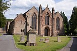
Wellington Heath

Wellington Heath is a small village and civil parish in Herefordshire, England, approximately 1.5 miles (2.4 km) north of Ledbury. The population was recorded by the 2011 census at 440.The village contains a church, Christ Church. There is a public house, the Farmers Arms.The Herefordshire Trail long-distance footpath passes through the village, as does The National Byway. The route of the derelict Herefordshire and Gloucestershire Canal passes through the western part of the parish. Wellington Heath has a parish council. The parish, together with the north part of the parish of Ledbury, forms the ward of Ledbury North, which returns one elected councillor to Herefordshire Council.
Excerpt from the Wikipedia article Wellington Heath (License: CC BY-SA 3.0, Authors, Images).Wellington Heath
Floyds Lane,
Geographical coordinates (GPS) Address Nearby Places Show on map
Geographical coordinates (GPS)
| Latitude | Longitude |
|---|---|
| N 52.059 ° | E -2.423 ° |
Address
Floyds Lane
Floyds Lane
HR8 1LR
England, United Kingdom
Open on Google Maps


