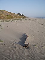
Pajaro River
Diablo RangeDrainage basins of Monterey BayGabilan RangeImportant Bird Areas of CaliforniaRivers of Monterey County, California ... and 6 more
Rivers of Northern CaliforniaRivers of San Benito County, CaliforniaRivers of Santa Clara County, CaliforniaRivers of Santa Cruz County, CaliforniaRivers of the San Francisco Bay AreaUse mdy dates from October 2022

The Pajaro River (pájaro is bird in Spanish) is a U.S. river in the Central Coast region of California, forming part of the border between San Benito and Santa Clara Counties, the entire border between San Benito and Santa Cruz County, and the entire border between Santa Cruz and Monterey County. Flowing roughly east to west, the river empties into Monterey Bay, west of Watsonville, California.
Excerpt from the Wikipedia article Pajaro River (License: CC BY-SA 3.0, Authors, Images).Pajaro River
Pelican Point,
Geographical coordinates (GPS) Address Nearby Places Show on map
Geographical coordinates (GPS)
| Latitude | Longitude |
|---|---|
| N 36.85 ° | E -121.80972222222 ° |
Address
Pajaro River Mouth Natural Preserve
Pelican Point
95039
California, United States
Open on Google Maps


