Harthausen Forest
Forests and woodlands of Baden-WürttembergHeilbronn (district)Hohenlohe (district)

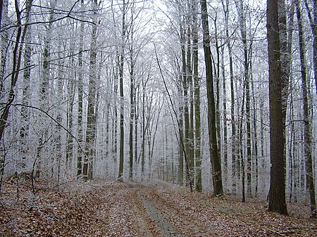
The Harthausen Forest (German: Harthäuser Wald) is a large forested area that – depending on the definition used – is 20 to over 30 km² in area. It lies in the north of Baden-Württemberg between the valleys of the lower reaches of the Jagst and Kocher on a hill ridge which is up to 334 m above sea level (NN). The largest part of the forest lies on the territory of Hardthausen am Kocher and thus in the county of Heilbronn district, a smaller part in the east is in Hohenlohekreis district. The forest derives its name from the settlement Harthausen near Lampoldshausen which was abandoned in the Late Middle Ages.
Excerpt from the Wikipedia article Harthausen Forest (License: CC BY-SA 3.0, Authors, Images).Harthausen Forest
L 1047, Hardthausen am Kocher
Geographical coordinates (GPS) Address Nearby Places Show on map
Geographical coordinates (GPS)
| Latitude | Longitude |
|---|---|
| N 49.3 ° | E 9.38722 ° |
Address
L 1047
74239 Hardthausen am Kocher
Baden-Württemberg, Germany
Open on Google Maps


