place

Ankenytown, Ohio

1848 establishments in OhioColumbus metropolitan area, Ohio geography stubsPopulated places established in 1848Unincorporated communities in Knox County, OhioUnincorporated communities in Ohio
Use mdy dates from July 2023

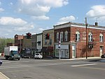
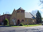
Ankenytown is an unincorporated community in Knox County, in the U.S. state of Ohio.

Excerpt from the Wikipedia article Ankenytown, Ohio (License: CC BY-SA 3.0, Authors).

Ankenytown, Ohio
Old Mansfield Road, Berlin Township

Geographical coordinates (GPS) Address Nearby Places
placeShow on map

Wikipedia: Ankenytown, OhioContinue reading on Wikipedia

Geographical coordinates (GPS)

Latitude Longitude
N 40.534166666667 ° E -82.505 °
placeShow on map

Address

Old Mansfield Road 20500
44813 Berlin Township
Ohio, United States
mapOpen on Google Maps

Share experience

Nearby Places

Ohio Country
Ohio Country

The Ohio Country, (Ohio Territory, Ohio Valley) was a name used before 1787 for a region of North America west of the Appalachian Mountains, north of the upper Ohio and Allegheny rivers, and extending to Lake Erie. The area encompassed present-day northwestern West Virginia, Western Pennsylvania, most of Ohio, and a wedge of southeastern Indiana. Control of the territory and the region's fur trade was disputed in the 17th century by the Iroquois, Huron, Algonquin, other Native American tribes, and France. New France claimed this area as part of the administrative district of La Louisiane. France and Britain fought the French and Indian War over this area in the mid-18th century as the North American front of their Seven Years' War (1753–1763). Following the British victory, France ceded its territory east of the Mississippi River to them in the 1763 Treaty of Paris. During the following decades, several minor frontier wars, including Pontiac's Rebellion and Lord Dunmore's War, were fought in the territory. In 1783, the Ohio Country became unorganized U.S. territory under the Treaty of Paris that officially ended the American Revolutionary War and became one of the first frontier regions of the United States. Several U.S. states had conflicting claims to portions of it, based on historical royal and colonial charters. The states' claims were largely extinguished after negotiations with the federal government by 1787, and it became part of the larger, organized U.S. Northwest Territory. Most of the former areas north and west of the Ohio River were organized as the state of Ohio, admitted to the Union in 1803.

Raleigh Mound
Raleigh Mound

The Raleigh Mound (33KN32) is a Native American mound in the village of Fredericktown, Ohio, United States. Built thousands of years ago, the mound is an important archaeological site. The site's original name was "Rowley Mound", given in honor of a Mr. Rowley, the property owner. Both spellings have been used by federal sources; different editions of United States Geological Survey maps use both spellings, the United States Board on Geographic Names officially determined to spell it "Rowley" in 1963, and the National Park Service lists it as "Raleigh" while noting "Rowley" as a variant.Raleigh measures approximately 20 feet (6.1 m) tall with a diameter of uncertain size, ranging between 80 feet (24 m) and 90 feet (27 m). Its precise size cannot be determined: the mound was built atop a small hill, and thousands of years of erosion have molded the two into a single shape. The mound was excavated at an uncertain time in the past, and the excavators recovered a distinctive artifact of a type of gorget known as an "expanded-center bar". Such a gorget is distinctive of sites affiliated with the mound-building Adena culture, which was responsible for heavy activity in the vicinity of modern Fredericktown — another Adena site, the Stackhouse Mound and Works, sits to the northeast less than 1 mile (1.6 km) away.In 1975, the Raleigh Mound was listed on the National Register of Historic Places, qualifying because of its archaeological importance. Significant to this designation was its relationship to the Stackhouse site, as the nearby placement of the latter's larger earthworks and village site meant that a detailed investigation of the mound would have a chance of providing archaeologists with an unusually detailed understanding of the people who built it.