Dandenong Ranges National Park
1987 establishments in AustraliaCity of KnoxForests of Victoria (state)IUCN Category IINational parks of Victoria (state) ... and 5 more
Pages with non-numeric formatnum argumentsParks of Greater Melbourne (region)Protected areas established in 1987Use Australian English from August 2014Yarra Ranges Shire

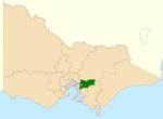
The Dandenong Ranges National Park is a national park located in the Greater Melbourne region of Victoria, Australia. The 3,540-hectare (8,700-acre) national park is situated from 31 kilometres (19 mi) at its westernmost points at Ferntree Gully and Boronia to 45 kilometres (28 mi) at it easternmost point at Silvan, east of the Melbourne central business district. The park was proclaimed on 13 December 1987 (1987-12-13), amalgamating the Ferntree Gully National Park, Sherbrooke Forest and Doongalla Estate. In 1997 the Olinda State Forest, Mt. Evelyn and Montrose Reserve were formally added to the national park.
Excerpt from the Wikipedia article Dandenong Ranges National Park (License: CC BY-SA 3.0, Authors, Images).Dandenong Ranges National Park
Wols Track, Melbourne Kalorama
Geographical coordinates (GPS) Address Nearby Places Show on map
Geographical coordinates (GPS)
| Latitude | Longitude |
|---|---|
| N -37.810277777778 ° | E 145.38555555556 ° |
Address
Wols Track
Wols Track
3766 Melbourne, Kalorama
Victoria, Australia
Open on Google Maps


