place

National Gallery of Canada

1882 establishments in OntarioArt museums and galleries in OntarioArt museums established in 1882Canadian federal Crown corporationsFederal departments and agencies of Canada
Festival venues in CanadaModern art museumsMoshe Safdie buildingsMuseums in OttawaNational galleriesNational museums of CanadaPostmodern architecture in CanadaSussex Drive
Ottawa ON National Gallery of Canada

The National Gallery of Canada (French: Musée des beaux-arts du Canada), located in the capital city of Ottawa, Ontario, is Canada's national art museum. The museum's building takes up 46,621 square metres (501,820 sq ft), with 12,400 square metres (133,000 sq ft) of space used for exhibiting art. It is one of the largest art museums in North America by exhibition space. The institution was established in 1880 at the Second Supreme Court of Canada building, and moved to the Victoria Memorial Museum building in 1911. In 1913, the Government of Canada passed the National Gallery Act, formally outlining the institution's mandate as a national art museum. The museum was moved to the Lorne building in 1960. In 1988, the museum was relocated to a new building designed for this purpose. The National Gallery of Canada is situated in a glass and granite building on Sussex Drive, with a notable view of the Canadian Parliament buildings on Parliament Hill. The building was designed by Israeli architect Moshe Safdie and opened in 1988.The museum's permanent collection includes over 93,000 works from European, American, and Asian, Canadian, and Indigenous artists. In addition to exhibiting works from its permanent collection, the museum also organizes and hosts a number of travelling exhibitions.

Excerpt from the Wikipedia article National Gallery of Canada (License: CC BY-SA 3.0, Authors, Images).

National Gallery of Canada
Sussex Drive, Ottawa Lowertown (Rideau-Vanier)

Geographical coordinates (GPS) Address Phone number Website External links Nearby Places
placeShow on map

Wikipedia: National Gallery of CanadaContinue reading on Wikipedia

Geographical coordinates (GPS)

Latitude Longitude
N 45.429444444444 ° E -75.698333333333 °
placeShow on map

Address

National Gallery of Canada

Sussex Drive 380
K1N 9N4 Ottawa, Lowertown (Rideau-Vanier)
Ontario, Canada
mapOpen on Google Maps

Phone number

call+16139901985

Website
gallery.ca

linkVisit website

linkWikiData (Q1068063)
linkOpenStreetMap (39036376)

Ottawa ON National Gallery of Canada
Share experience

Nearby Places

Major's Hill Park
Major's Hill Park

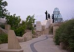
Major's Hill Park is a park in downtown Ottawa, Ontario. The park stands above the Rideau Canal at the point where it enters the Ottawa River. The parliament buildings can be seen across the canal to the west, to the north of the park is the National Gallery of Canada, and to the east are the United States embassy and the Byward Market. To the south is the Chateau Laurier hotel, built on land that was once part of the park. The neighbourhood surrounding the park was once home to those who constructed the canal. In particular, the area that is now the park was the official residence of the Superintending Engineer of the Rideau Canal, Lieutenant-Colonel John By until he returned to England in 1832. The hill was known at the time as "Colonel's Hill". By was replaced in 1832 by Captain Daniel Bolton who took up residence in By's house. In 1838 Bolton was promoted to Major. By the time he left the Bytown in 1843, the hill had become known as Major's Hill. Commemorative plaques and a statue of Lieutenant-Colonel By, Major Bolton and their successors were erected in Major's Hill Park.The residence was destroyed by fire on October 5, 1848, though ruins survive to today. The use of the area as a residence means that the park has remained a green space since the early days of Ottawa. It is now managed by the National Capital Commission, which has placed historical information in the northwest corner of the park. Due to its central location, Major's Hill Park is frequented all year round. It is frequently used as a venue for events, and is central to Ottawa's civic Canada Day celebrations. A more recent addition to the calendar is the annual 'B In The Park', which precedes the Glengarry Highland Games. Pipe bands and highland dancers from all over the world perform. It is presented by the Sons of Scotland Pipe Band of Ottawa, which claims to be Canada's oldest continuous civilian pipe band.

Kìwekì Point
Kìwekì Point

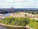
Kìwekì Point (), formerly Nepean Point is a hill overlooking the Ottawa River in Ottawa, Ontario, Canada. It is located between the National Gallery of Canada and Alexandra Bridge. The site is managed by the National Capital Commission (NCC). The hill had originally been named after Evan Nepean. At the peak of the hill is a statue of French explorer Samuel de Champlain holding his famous astrolabe upside-down. It was made by sculptor Hamilton MacCarthy in 1915. Previously, the statue also featured a kneeling Anishinabe scout, added in 1918 to "signify how the native people helped Champlain navigate through the waters of the Ottawa River". The scout statue has since been relocated to nearby Major's Hill Park and was renamed "Kitchi Zibi Omàmìwininì" in 2013. The original site also featured several other sculptures and an amphitheatre known as "Astrolabe Theatre". In November 2019, the site was closed to begin a redevelopment project lead by Janet Rosenberg & Studio, Patkau Architects, Blackwell Structural Engineers, and ERA Architects Inc. The new site, scheduled for completion in 2024, will feature two accessible lookouts, a shelter, and a pedestrian bridge connecting the site to Major's Hill Park. During the development's planning, the NCC consulted with representatives of Kitigan Zibi Anishinabeg and the Algonquins of Pikwàkanagàn. On October 4, 2022, Nepean Point was renamed Kìwekì Point in order to "highlight Algonquin voices, and showcase Algonquin culture and language". Kìwekì means "returning to one's homeland" in Algonquin.