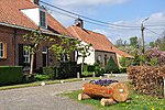
Wortel, Belgium
Antwerp geography stubsFormer municipalities of Antwerp ProvincePopulated places in Antwerp ProvinceSub-municipalities of Hoogstraten

Wortel is a village in the Belgian municipality of Hoogstraten. As of 2021, it has 1,844 inhabitants.The toponym means carrot or root in Dutch. Wortel was established in the early 19th century by the Society of Benevolence as a farming colony for the able-bodied working poor. It was meant to provide employment during a time when poverty rates were very high in the Low Countries. Along with the other colonies constructed by the Society of Benevolence, Wortel was inscribed on the UNESCO World Heritage List in 2021 as an excellent example of a unique method of housing reform and urban planning.
Excerpt from the Wikipedia article Wortel, Belgium (License: CC BY-SA 3.0, Authors, Images).Wortel, Belgium
Kerkpad,
Geographical coordinates (GPS) Address Nearby Places Show on map
Geographical coordinates (GPS)
| Latitude | Longitude |
|---|---|
| N 51.3978 ° | E 4.7958 ° |
Address
Kerkpad 4
2323
Antwerp, Belgium
Open on Google Maps


