place

Pacifica High School (Garden Grove, California)

1965 establishments in CaliforniaAll Wikipedia neutral point of view disputesEducation in Garden Grove, CaliforniaEducational institutions established in 1965High schools in Orange County, California
Public high schools in CaliforniaUse mdy dates from December 2019Wikipedia neutral point of view disputes from April 2020
Pacifica HS logo
Pacifica HS logo

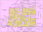
Pacifica High School is a high school in Garden Grove, California, United States, within the Garden Grove Unified School District. It opened in 1965 and has enrolled more than two thousand students yearly. The communities serving Pacifica are western Garden Grove and sections of Stanton and Cypress.

Excerpt from the Wikipedia article Pacifica High School (Garden Grove, California) (License: CC BY-SA 3.0, Authors, Images).

Pacifica High School (Garden Grove, California)
Lampson Avenue, Garden Grove

Geographical coordinates (GPS) Address External links Nearby Places
placeShow on map

Wikipedia: Pacifica High School (Garden Grove, California)Continue reading on Wikipedia

Geographical coordinates (GPS)

Latitude Longitude
N 33.781388888889 ° E -118.01361111111 °
placeShow on map

Address

Pacifica High School

Lampson Avenue 6851
92845 Garden Grove
California, United States
mapOpen on Google Maps

linkWikiData (Q7122803)
linkOpenStreetMap (195017624)

Pacifica HS logo
Pacifica HS logo
Share experience

Nearby Places

West Garden Grove, Garden Grove, California

West Grove, officially recognized as the West Grove Business District by the City of Garden Grove, and sometimes called West Garden Grove, is a neighborhood in the city of Garden Grove, located in Orange County, California, United States. West Grove encompasses the pene-exclave western portion of the city of Garden Grove. It is bordered to the north by Cypress, to the west by Los Alamitos and Seal Beach, to the south by Westminster, and to the east by Stanton, and connected to the rest of Garden Grove by a narrow strip along Garden Grove Boulevard. It includes the entire 92845 ZIP Code, which is designated as the areas west of Knott Avenue to the Seal Beach and Los Alamitos city borders, and the industrial area east of Knott Avenue to the Stanton border. The community is more "affluent" than the rest of Garden Grove, with a median income $25,000 greater than the main body of the city. There is also less crime, a lower poverty rate, and lower population density compared to the rest of Garden Grove. As of the 2010 Census, 16,333 people reside in West Grove.Historically, the term West Garden Grove, or West Grove, was used only on unofficial basis and was not recognized by the city of Garden Grove; however, on May 8, 2018, the Garden Grove City Council approved a resolution by Garden Grove City Councilman Kris Beard of District One, the city election district that covers West Grove, officially recognizing West Grove Business District as a district.