place

Church of St Andrew, Blagdon
15th-century church buildings in EnglandGrade II* listed buildings in North SomersetGrade II* listed churches in Somerset
Blagdon church
Blagdon church

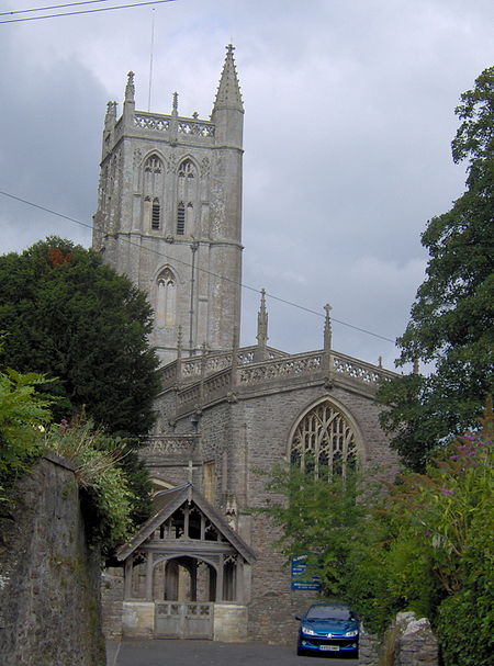
The Anglican Church Of St Andrew in Blagdon, within the English county of Somerset, was built in the 15th century. It is a Grade II* listed building.The church has a 116 feet (35 m) high tower with pinnacles and a cusped lozenge pattern parapet, with a stair turret spirelet in the north-east corner. The tower dates from the 15th century and is one of the tallest in Somerset. The tower contains a bell dating from 1716 and made by Edward Bilbie of the Bilbie family. The remainder of the church was rebuilt in 1907–09 by Lord Winterstoke (of the Wills tobacco family)The interior includes a romanesque piscina set into the south wall of the chancel.The lychgate to the east of the church is a Grade II listed building in its own right. Above the door are four primitive Norman carvings which survived three rebuildings.Augustus Toplady was serving as curate of St Andrew's in the 1760s when he wrote the hymn Rock of Ages. It is believed that he was inspired to write the lyrics while sheltering under a rock in nearby Burrington Combe.In 2013 fundraising was undertaken to provide toilets and a new kitchen in the church. Improvements were also made to the damp proofing and insulation.The parish is part of the benefice of Blagdon with Charterhouse, Compton Martin and Ubley within the Diocese of Bath and Wells.

Excerpt from the Wikipedia article Church of St Andrew, Blagdon (License: CC BY-SA 3.0, Authors, Images).

Church of St Andrew, Blagdon
Tims Well Batch,

Geographical coordinates (GPS) Address External links Nearby Places
placeShow on map

Wikipedia: Church of St Andrew, BlagdonContinue reading on Wikipedia

Geographical coordinates (GPS)

Latitude Longitude
N 51.327777777778 ° E -2.7130555555556 °
placeShow on map

Address

Saint Andrew's

Tims Well Batch
BS40 7SB
England, United Kingdom
mapOpen on Google Maps

linkWikiData (Q17534309)
linkOpenStreetMap (133386993)

Blagdon church
Blagdon church
Share experience

Nearby Places

Charterhouse Camp
Charterhouse Camp

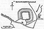
Charterhouse Camp is a univallate Iron Age hillfort in the Mendip district of Somerset, England. The hillfort is situated approximately 0.6 miles (0.97 km) east from the village of Charterhouse. There is some evidence, in the form of burials in local caves, of human occupation since the late Neolithic times and the early Bronze Age. The site is associated with Charterhouse Roman Town and may have been the site of Iscalis. The site is a scheduled monument.Hillforts developed in the Late Bronze and Early Iron Age, roughly the start of the first millennium BC. The reason for their emergence in Britain, and their purpose, has been a subject of debate. It has been argued that they could have been military sites constructed in response to invasion from continental Europe, sites built by invaders, or a military reaction to social tensions caused by an increasing population and consequent pressure on agriculture. The dominant view since the 1960s has been that the increasing use of iron led to social changes in Britain. Deposits of iron ore were located in different places to the tin and copper ores necessary to make bronze, and as a result trading patterns shifted and the old elites lost their economic and social status. Power passed into the hands of a new group of people.Archaeologist Barry Cunliffe believes that population increase still played a role and has stated "[the forts] provided defensive possibilities for the community at those times when the stress [of an increasing population] burst out into open warfare. But I wouldn't see them as having been built because there was a state of war. They would be functional as defensive strongholds when there were tensions and undoubtedly some of them were attacked and destroyed, but this was not the only, or even the most significant, factor in their construction".