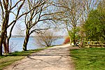
West Leigh and Bedford railway station
Beeching closures in EnglandDisused railway stations in the Metropolitan Borough of WiganFormer Great Central Railway stationsPages with no open date in Infobox stationRailway stations in Great Britain closed in 1964 ... and 2 more
Railway stations in Great Britain opened in 1884Use British English from March 2018

The West Leigh and Bedford railway station served the hamlet of Crankwood, the village of Abram, and the Plank Lane area of Leigh, England. Like many railways, the line passed between rather than through communities, with branches off to serve the key driver - goods, and in this area - coal.
Excerpt from the Wikipedia article West Leigh and Bedford railway station (License: CC BY-SA 3.0, Authors, Images).West Leigh and Bedford railway station
Crankwood Road,
Geographical coordinates (GPS) Address Nearby Places Show on map
Geographical coordinates (GPS)
| Latitude | Longitude |
|---|---|
| N 53.495174 ° | E -2.569067 ° |
Address
Crankwood Road/Sherwood House
Crankwood Road
WN7 4PP
England, United Kingdom
Open on Google Maps


