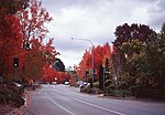
Heathfield, South Australia

Heathfield is a township in the Adelaide Hills of South Australia near Stirling. It is home to Heathfield High School, Heathfield Primary School, Heathfield Oval, the Heathfield Waste Depot, Mount Lofty Sand and Metal, Masonic homes (retirement Village), a biodynamic farm and a proposed service station development, along with numerous walking trails. Heathfield is also located close to Mount Lofty Ranges. The small country suburb of Heathfield also contains a small conservation park known as Woorabinda. This is used daily by residents to walk their dogs; and ducks to receive free food. The proposed service station is currently a source of controversy, with some local residents creating a petition against the development and others supporting it. The Adelaide Hills Council have also opposed the development. Heathfield is a mix of country living, while still being only 15 minutes from the Adelaide City centre. As such, it has a diverse mix of middle, to upper middle class residents seeking a secluded home, and farmers. At the 2006 census, Heathfield had a population of 1,000, and a median house price of $632,000.
Excerpt from the Wikipedia article Heathfield, South Australia (License: CC BY-SA 3.0, Authors, Images).Heathfield, South Australia
Hender Road, Adelaide Hills Council
Geographical coordinates (GPS) Address Nearby Places Show on map
Geographical coordinates (GPS)
| Latitude | Longitude |
|---|---|
| N -35.016666666667 ° | E 138.71666666667 ° |
Address
Unnamed (No.HA1595) Heritage Agreement
Hender Road
5153 Adelaide Hills Council, Heathfield
South Australia, Australia
Open on Google Maps


