Langwedel
Lüneburg region geography stubsMunicipalities in Lower SaxonyVerden (district)

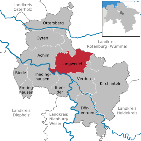
Langwedel is a municipality in the district of Verden, in Lower Saxony, Germany. It is situated on the right bank of the Weser, approx. 7 km northwest of Verden, and 30 km southeast of Bremen. Langwedel belonged to the Prince-Bishopric of Verden, established in 1180. In 1648 the Prince-Bishopric was transformed into the Principality of Verden, which was first ruled in personal union by the Swedish Crown - interrupted by a Danish occupation (1712–1715) - and from 1715 on by the Hanoverian Crown. The Kingdom of Hanover incorporated the Principality in a real union and the Princely territory, including Langwedel, became part of the new Stade Region, established in 1823.
Excerpt from the Wikipedia article Langwedel (License: CC BY-SA 3.0, Authors, Images).Langwedel
Achimer Straße,
Geographical coordinates (GPS) Address Nearby Places Show on map
Geographical coordinates (GPS)
| Latitude | Longitude |
|---|---|
| N 52.966666666667 ° | E 9.2166666666667 ° |
Address
Achimer Straße
Achimer Straße
27283 , Dauelsen
Lower Saxony, Germany
Open on Google Maps


