place

St Paul's Church, Leicester

2003 disestablishments in EnglandChurch of England church buildings in LeicesterChurches completed in 1871Grade II listed churches in Leicestershire
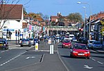
The Old Church of Saint Paul's, Leicester geograph.org.uk 489679

St Paul's Church, Leicester is a Grade II listed former parish church in the Church of England in Kirby Road, Leicester, Leicestershire.

Excerpt from the Wikipedia article St Paul's Church, Leicester (License: CC BY-SA 3.0, Authors, Images).

St Paul's Church, Leicester
Kirby Road, Leicester West End

Geographical coordinates (GPS) Address Nearby Places
placeShow on map

Wikipedia: St Paul's Church, LeicesterContinue reading on Wikipedia

Geographical coordinates (GPS)

Latitude Longitude
N 52.634416666667 ° E -1.1535861111111 °
placeShow on map

Address

Kirby Road 1
LE3 6BD Leicester, West End
England, United Kingdom
mapOpen on Google Maps

The Old Church of Saint Paul's, Leicester geograph.org.uk 489679
Share experience

Nearby Places

Newfoundpool

Newfoundpool is an area of Leicester lying south of the former Leicester and Swannington Railway. The land was purchased by market gardener Isaac Harrison in around 1830. Harrison intended to develop the area as a spa, using a spring as the source of water for a Hydrotherapy and bathing establishment, but the venture failed after a few years. Later the building was converted into a residence, Newfoundpool House, in which successive members of the Harrison family lived until 1885, with the land passing to Harrison's nephew, also named Isaac, and then his daughter Beatrice. The house became the Empire Hotel on Fosse Road North. A Leicester builder, Orson Wright, purchased the land in 1885. Wright laid out roads across the area and sold off the land as building plots. The majority of houses built were of the two-storey terraced type, brick-built, with the corner sites constructed as shops. Along Fosse Road North a number of three- and four-storey red-brick villas were built. Until 1891 Newfoundpool was outside the Borough of Leicester, the border running along Fosse Road North. On the same road the parish church of St. Augustine was built over the period 1900 to 1912. The church itself has been abandoned since 2000 and was severely damaged by an arson attack in 2004.The Newfoundpool School Board was established in 1889 to address the shortage of school places in the area. It estimated that there were 500 children of school age living in Newfoundpool in 1889 and supervised the construction of the Ingle Street Board School (now the building of Inglehurst Junior School) on land purchased on favourable terms from Orson Wright. The Newfoundpool School Board was dissolved in 1891 and incorporated into the Leicester School Board when the Borough boundaries were extended. The Fosse Cinema on Fosse Road North later became a bingo hall but was demolished to make way for a Tesco Express shop and filling station. https://www.facebook.com/groups/Fossecinema/ The area's connection with the Harrison family is commemorated by an acrostic, "IHARRISON", formed by the initial letters of the street names between Pool Road and Beatrice Road.Newfoundpool is part of Fosse Ward and the Leicester West parliamentary constituency.

Bromkinsthorpe

The Domesday manor of Bromkinsthorpe was situated outside the West Gate of Leicester, on the alluvial west bank of the River Soar. Its location is now covered by the area around Braunstone Gate, Leicester, and for much of the medieval period was a liberty within the parish of St Mary de Castro, Leicester, and hence, part of the Borough of Leicester. Bromkinsthorpe was bisected by the Roman road later known as Fosse Way, which led from Lincoln via Leicester to Cirencester and Exeter. It is presumed this road formed an early north western frontier to the Roman province of Britannia following the original invasion. Whilst there was a Roman villa in what later became Bromkinsthorpe, the first mention of the manor was in the Domesday Book of 1086. At that time it was held by Hugh de Grandmesnil along with 64 other manors in Leicestershire. He held six carucates in Bromkinsthorpe outright, with another two that formed part of the Soke of Ratby in west Leicestershire. In the Domesday Book the manor was recorded as belonging to Leicester, although it is not clear what this statement signified. There was also a link with the manor of Smeeton in south Leicestershire as four sokemen from there were 'attached' to Hugh de Grandmesnil's land in Bromkinsthorpe. Later, Bromkinsthorpe became part of the Earls of Leicester holdings. Two manors were recorded at Bromkinsthorpe in the 13th century. One was Walsh or Danet's Hall. The second was Westcotes. Both of these manors and their tenants are clearly documented thenceforward. Inhabitants farmed the open field strips surrounding the two manors. Some records suggest these strips formed one of the great open fields of Leicester. Others indicate that Bromkinsthorpe itself had three great open fields. The abbey of St Mary de Pratis, Leicester held considerable land in Bromkinsthorpe. The inhabitants also had rights in Leicester Forest, for which they were compensated when it was deforested in 1628. The manors were largely enclosed by the end of the 17th century. During the 18th century, urban Leicester encroached the manors, with some large houses, complete with extensive grounds and orchards built. These were demolished in the 19th century when new high-density housing was built that obliterated the rural aspect of Bromkinsthorpe. The manors were thus subsumed into the rapidly expanding Borough of Leicester.