place

Haldon Belvedere

Grade II* listed buildings in Devon
HaldonBelvedere Devon England

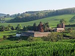
Haldon Belvedere or Lawrence Tower is a triangular tower in the Haldon Hills in the county of Devon, England. Haldon Belvedere is in the parish of Dunchideock within the former Haldon estate, about a mile south-west of Haldon House. Its location on the ridge of the Haldon Hills gives it extensive views and means it is a prominent landmark for many miles around. It was built in 1788 by Sir Robert Palk, 1st Baronet and was originally called Lawrence Tower in honour of his friend and patron General Stringer Lawrence (1697–1775). Lawrence spent much of his retirement at Haldon and was buried in Dunchideock church, in which Palk erected a monument to his memory, having received a bequest of £50,000 in his will. Stringer Lawrence's other monument is in Westminster Abbey, erected by the East India Company.The tower, 26 metres high, is triangular with Gothic windows and full-height circular angle turrets, and was probably influenced by the triangular tower at nearby Powderham Castle, itself probably modelled on Shrubs Hill Tower (now Fort Belvedere) in Windsor Great Park, built 1750–1755. Inside is a larger-than-life-size coade stone statue of Stringer Lawrence dressed as a Roman general; a copy of the marble statue of him by Peter Scheemakers (1691–1781) now in the Foreign and Commonwealth Office, formerly the India Office. On the walls are three large framed tablets inscribed with details of his career.In 1925 when the former Palk-owned Haldon estate was being broken up, the belvedere was sold for £300 at auction to J. Archibald Lucas and J. B. Orchard, both of Exeter. It was later owned by Mrs Bessie Smith who sold it in 1933 for £650 to Mrs Annie Dale from Wolverhampton. Mrs Dale and her three sons lived at the belvedere and opened it to the public, running a teahouse and gift shop and charging 2d. to climb to the top of the tower. During World War II the Dale sons were conscientious objectors and were jailed for a time, later being allowed to work locally for the war effort. With its far-reaching views, the belvedere served as a strategic observation post and after the war, Mrs Dale was awarded £405 for damage caused to the building's interior, with damage caused to the stairs by hobnail boots being specifically mentioned.After the war and the death of their parents, two of the sons, Cyril and Edward, continued to live in the building, but having few means they were unable to maintain it well and it deteriorated. It was struck by lightning in 1960 and in 1990 the windows were blown out in a storm. Cyril Dale died in 1990 and just before his own death in 1994 his brother Edward transferred the building to the Stringer Lawrence Memorial Trust which arranged for restoration work by the Devon Historic Buildings Trust. After extensive work funded by grants from a number of sources including English Heritage, the belvedere was officially reopened by Lucinda Lambton on 20 April 1996. Further restoration of the exterior took place in 2016. It has been a grade II* listed building, under the name of "Lawrence Castle", since 1987.

Excerpt from the Wikipedia article Haldon Belvedere (License: CC BY-SA 3.0, Authors, Images).

Haldon Belvedere
Footbath to Dunchideock or Haldon Forest, Teignbridge Dunchideock

Geographical coordinates (GPS) Address Nearby Places
placeShow on map

Wikipedia: Haldon BelvedereContinue reading on Wikipedia

Geographical coordinates (GPS)

Latitude Longitude
N 50.6641 ° E -3.59273 °
placeShow on map

Address

Haldon Belvedere (Lawrence Castle)

Footbath to Dunchideock or Haldon Forest
EX6 7QY Teignbridge, Dunchideock
England, United Kingdom
mapOpen on Google Maps

HaldonBelvedere Devon England
Share experience

Nearby Places

Dunchideock
Dunchideock

Dunchideock ( DUN-chi-dək, dun-CHID-ee-ək) is a small civil parish on the north eastern slopes of the Haldon Hills in Teignbridge, Devon, England. It covers an area of 392 hectares (970 acres) and lies about 6 km (3.7 mi) south-west of Exeter and 11 km (6.8 mi) north-east of Bovey Tracey. The parish, with a population of 262 in 2001, lacks a compact village, but consists of scattered dwellings. It is surrounded clockwise from the north by the parishes of Holcombe Burnell, Ide, Shillingford St. George, Kenn, and Doddiscombsleigh.The name Dunchideock is of Celtic origin. Recorded in the Domesday Book of 1086 as Donsedoc, the two parts of the name derive from dun (fort) and coediog (wooded), which, according to W. G. Hoskins, refer to the nearby Iron Age hill fort of Cotley Castle.The parish church is dedicated to St Michael and is Grade I listed. It originated in 1308 at the latest, but the present church building, built of red sandstone, was started in the late 14th century. It has been partially rebuilt and restored many times. There is a good font dated to around 1400, some notable carved bench-ends, roof-bosses and rood-screen; and several memorials, most notably to Aaron Baker, who rebuilt the chancel aisle in 1669, and Stringer Lawrence. The theological writer Bourchier Wrey Savile was rector of Dunchideock with Shillingford St. George from 1872 to his death in 1888.Within the parish was the former Haldon House which was the home of Sir Robert Palk, 1st Baronet. Mostly demolished in the 1920s, the remaining wing is now the Best Western "Lord Haldon Hotel". Also in the parish is Haldon Belvedere, a triangular tower on top of Haldon that was built by Palk in 1788 in memory of his friend General Stringer Lawrence.Archie Winckworth, the former owner of Dunchideock House, posted a memoir about the village and its history, including an account of its buried treasure. The cellars of Dunchideock House are fancifully supposed to contain a treacle mine.

Trusham
Trusham

Trusham is a small village in the Teign Valley, between Newton Abbot and Exeter, in Devon, England. The name originates from the Celtic Trisma, meaning "brushwood" or "fallen leaves". It became Trisme for about 400 years, and then in the 16th century Tryssame or Trysham. A pub, the Cridford Inn, was opened in 1985 by converting part of an old farmhouse and adjoining barn.The Church of St Michael is an ancient stone building in the early English and Perpendicular styles with traces of Norman work. The church was thoroughly restored in 1865, when the stained east window and a smaller one were inserted as memorials to the Rev. William Edward Brendon, who died in 1864. There is also a memorial to John Stooke which mentions a charity he set up for the church and the poor of nearby Bovey Tracey.Trusham was the ancestral home of the Causley family, whose descendants include the poet Charles Causley and the folk singer Jim Causley. Causley's poem "Trusham" is an account of a return he made to the village in his later years; a reflection on one's family roots, what it is to be distant from those, and the legacies we leave behind us. Jim Causley's setting of this poem—amongst a number of other poems by his distant relation—is a modern song-setting, and is available on the album Cyprus Well. A later poem, "The Prodigal Son", recounts a further visit by Causley to his ancestral village, linking once again the local geography, history and landscape with the First World War and his own family memories. In 2007, Trusham held the first Charles Causley Festival in conjunction with the Charles Causley Society of Launceston. There is a plaque in the village to celebrate Causley's life and the Charles Causley Society hold regular events in Trusham such as Causley readings and poems set to music, hog roasts and barn dancing. The now disused and privately-owned Trusham railway station was part of the Teign Valley Line. Although the school closed in November 1948, its Victorian building is now the Village Hall. The Doomsday survey of 1086 recorded a settlement of 23 households (four of villagers, nine of smallholders, ten of slaves). Eight hundred years later, the 1881 Census recorded a very small growth, with 41 households and a population of 177; however, in Kelly’s 1901 Directory of Devonshire, the population had fallen to 165. By 2001, whilst the number of households had increased to 60, the population had fallen further to 144. Trusham is on the western side of the 250 m (820 ft) high Haldon Hills, roughly 90 m (300 ft) above the river Teign, which forms the Dartmoor National Park boundary and is just over one-half mi (0.80 km) away. The village is accessed via minor roads which are predominantly single track with passing places. The A38 passes within 2 mi (3.2 km) at Chudleigh. The centre of the village has the O S grid reference SX 854 821 and for sat nav users the postcode is TQ13 0NW.