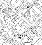
Marylone, Gloucester

Marylone (sometimes called St Mary's Lane) is a short pedestrian street in Gloucester that runs from Southgate Street to Addison's Folly.The street is entered from Southgate Street through the same archway that provides access to the old Crypt School. On its south side is the graveyard for St Mary de Crypt church, and on the north commercial premises. The street was probably laid out during the replanning of Gloucester in the 10th century by Queen Æthelflæd who was a daughter of King Alfred. Although the street is now very short, during the medieval period it went as far as the eastern city wall. The street is now almost entirely taken up with seating for Cafe Rene. The street is paved with carboniferous limestone with borders of cobbles.
Excerpt from the Wikipedia article Marylone, Gloucester (License: CC BY-SA 3.0, Authors, Images).Marylone, Gloucester
Southgate Street, Gloucester
Geographical coordinates (GPS) Address Nearby Places Show on map
Geographical coordinates (GPS)
| Latitude | Longitude |
|---|---|
| N 51.86433 ° | E -2.24704 ° |
Address
Crypt Schoolroom
Southgate Street
GL1 1TP Gloucester
England, United Kingdom
Open on Google Maps


