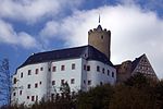
Gehringswalde
ErzgebirgskreisVillages in the Ore MountainsWolkenstein
Gehringswalde, a so-called Waldhufendorf, is situated about 1.5 km east of Wolkenstein in the Ore Mountains. It extends for about 1.5 km along the valley of a stream which joins the Zschopau river ca. 1.5 km west of Warmbad. The nearby Hüttengrundmühle (site of a former water mill) is also part of the village. The mountain Dreibrüderhöhe lies ca. 3 km east of Gehringswalde. Bundesstraße 101 forms the main road of the village, at whose western end it is joined by Bundesstraße 171. A county road connects Gehringswalde with Warmbad.
Excerpt from the Wikipedia article Gehringswalde (License: CC BY-SA 3.0, Authors).Gehringswalde
B 101,
Geographical coordinates (GPS) Address Nearby Places Show on map
Geographical coordinates (GPS)
| Latitude | Longitude |
|---|---|
| N 50.659722222222 ° | E 13.089722222222 ° |
Address
B 101
09429
Saxony, Germany
Open on Google Maps


