place

Winfield Creek

Rivers of PennsylvaniaRivers of Union County, PennsylvaniaTributaries of the West Branch Susquehanna River
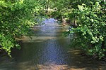
Winfield Creek looking upstream

Winfield Creek (also known as Dry Run) is a tributary of the West Branch Susquehanna River in Union County, Pennsylvania, in the United States. It is approximately 4.4 miles (7.1 km) long and flows through Union Township. The watershed of the creek has an area of 5.38 square miles (13.9 km2). The creek is designated as an impaired stream, with the causes being habitat alteration and sedimentation/siltation. The creek is designated as a Warmwater Fishery and a Migratory Fishery, but is not a trout fishery.

Excerpt from the Wikipedia article Winfield Creek (License: CC BY-SA 3.0, Authors, Images).

Winfield Creek
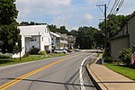
Reitz Avenue, Union Township

Geographical coordinates (GPS) Address Nearby Places
placeShow on map

Wikipedia: Winfield CreekContinue reading on Wikipedia

Geographical coordinates (GPS)

Latitude Longitude
N 40.9129 ° E -76.8502 °
placeShow on map

Address

Reitz Avenue (T364)

Reitz Avenue
17889 Union Township
Pennsylvania, United States
mapOpen on Google Maps

Winfield Creek looking upstream
Share experience

Nearby Places

Chillisquaque Creek
Chillisquaque Creek

Chillisquaque Creek is a tributary of the West Branch Susquehanna River in Montour County and Northumberland County, in Pennsylvania, in the United States. It is approximately 20.2 miles (32.5 km) long and flows through Derry Township, Washingtonville, and Liberty Township in Montour County and East Chillisquaque Township and West Chillisquaque Township in Northumberland County. The watershed of the creek has an area of 112 square miles (290 km2). Agricultural impacts have caused most of the streams in the watershed of the creek (including the main stem) to be impaired. Causes of impairment include sedimentation/siltation and habitat alteration. The average annual discharge of the creek between 1980 and 2014 ranged from 48.2 to 146.0 cubic feet per second (1.36 to 4.13 m3/s). Its watershed mainly consists of rolling agricultural land. The creek's channel flows through rock formations consisting of sandstone and shale. It is a warmwater stream. The watershed of Chillisquaque Creek occupies parts of four counties: Columbia County, Montour County, Northumberland County, and Lycoming County. There is a gauging station along the creek near Washingtonville. A Shawnee village had been established at the confluence with the West Branch Susquehanna River by 1728. A fort known as Fort Bosley also historically existed on the creek near Washingtonville. Numerous bridges were built over the creek in the 19th and 20th centuries, two of which are on the National Register of Historic Places. The creek is designated as a Warmwater Fishery and a Migratory Fishery. It lacks trout, but has in the past been stocked with various other fish species. A tract of the creek's floodplain is known as the Chillisquaque Creek Natural Area and is owned by Bucknell University. Various bird species have been observed near it and woodland wildflowers inhabit the creek's vicinity. Recreational opportunities in the watershed include canoeing and fishing.