place

Île Bizard

Hochelaga ArchipelagoL'Île-Bizard–Sainte-GenevièveLandforms of MontrealRiver islands of QuebecUse Canadian English from January 2023
West Island
Ecole du village 03
Ecole du village 03

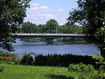
Île Bizard is an island near the Island of Montreal in the Hochelaga Archipelago region. It is one of the three populated islands within the city of Montreal, along with the Island of Montreal and Nuns' Island (Île des Soeurs). The island is served by buses 207 and 407.

Excerpt from the Wikipedia article Île Bizard (License: CC BY-SA 3.0, Authors, Images).

Île Bizard
Großenscheidt,

Geographical coordinates (GPS) Address Nearby Places
placeShow on map

Wikipedia: Île BizardContinue reading on Wikipedia

Geographical coordinates (GPS)

Latitude Longitude
N 45.483333333333 ° E -73.9 °
placeShow on map

Address

Großenscheidt 21
42499
Nordrhein-Westfalen, Deutschland
mapOpen on Google Maps

Ecole du village 03
Ecole du village 03
Share experience

Nearby Places

Cap-Saint-Jacques Nature Park

Cap-Saint-Jacques Nature Park is a large nature park in the Pierrefonds-Roxboro borough of Montreal, Quebec, Canada. It is located in the West Island at the junction of the Lake of Two Mountains and the Rivière des Prairies. Situated on a peninsula, three quarters of the park is bordered by water. At 330 ha (820 acres), it is the largest park in Montreal. The land for the park was purchased by the City of Montreal on 15 February 1980 from the Congregation des Soeurs des Saints Noms de Jesus et de Marie.The park features a natural sand beach and an organic farm, which raises animals and grows organic produce. Farm activities are offered by the non profit D-Trois-Pierres.The park's bays are home to a variety of animals, including the map turtle. Environmental science activities are offered by the Groupe uni des éducateurs-naturalistes et professionnels en environnement (GUEPE). The park includes stands of silver birch and sugar maple, with a sugar shack where visitors can watch the production of maple syrup, in season. The park has 26 km (16 mi) of hiking trails and 32 km (20 mi) of trails for cross country skiing.The name "Cap St. Jacques" was written on maps as early as 1744. The land mass south of the (cape) of Cap St. Jacques is the Jacques Cartier electoral district. The French Wikipedia article conjectures the name comes from Jacques Bizard, but both Jacques Cartier and Jacques Bizard have not been named Saints. There is a street named "St. Jacques" in the city of Montreal dated 1672. There is also a land area called the Saint-Jacques Escarpment on the island of Montreal.