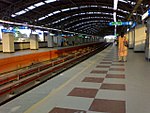
Ward No. 114, Kolkata Municipal Corporation
Municipal wards of KolkataUse Indian English from May 2018
Ward No. 114, Kolkata Municipal Corporation {ওয়ার্ড নম্বর ১১৪, কলকাতা পৌরসংস্থা} is an administrative division of Kolkata Municipal Corporation in Borough No. 11, surrounding all around this region are Bansdroni, Paschim Putiary, Kudghat, Haridevpur(partly), Rajpur Sonarpur(partly)(Rania 30 feet) Ramkantapur(under Behala Purba (Vidhan Sabha constituency), pincode-7000104)(partly) as nearby of all the above. This Region is located in the south of the Tolly's Nullah (Adi Ganga) in the city of Kolkata of the state of West Bengal of the country of India .This area is covered to Purba Putiary area.
Excerpt from the Wikipedia article Ward No. 114, Kolkata Municipal Corporation (License: CC BY-SA 3.0, Authors).Ward No. 114, Kolkata Municipal Corporation
Kolkata Purba Putiary
Geographical coordinates (GPS) Address Nearby Places Show on map
Geographical coordinates (GPS)
| Latitude | Longitude |
|---|---|
| N 22.476833 ° | E 88.348806 ° |
Address
700092 Kolkata, Purba Putiary
West Bengal, India
Open on Google Maps

