place

Arroyo Simi

Geography of Simi Valley, CaliforniaMoorpark, CaliforniaRivers of Southern CaliforniaRivers of Ventura County, CaliforniaSanta Susana Mountains
Simi HillsWashes of California
Arroyo Simi Biking Trail seen from Frontier Park Simi Valley

The Arroyo Simi (Spanish for "Small Stream of Simi", sometimes also referred to as Simi Creek) is a 19-mile (31 km) westwards-running creek, located in California, United States, running from the city of Simi Valley and crosses the valley from east to west, before entering the city of Moorpark. It originates at Corriganville Park by the Santa Susana Pass, travels for 12 miles (19 km) through Simi Valley, leaves the city limits of Oak Park at the western end of Simi Valley, continues for seven miles in Moorpark where it merges with Arroyo Las Posas by Hitch Road. It is a tributary to the Calleguas Creek, which enters the Pacific Ocean by its estuary at Mugu Lagoon by Naval Air Station Point Mugu. Arroyo Simi drains an area of 343 square miles in southern Ventura County. In its natural state, it is an ephemeral creek, which is only seasonally filled during winter time and periods of heavy rain. Today it is for the most part a concrete lined water drain that flows year round. Tributaries to the Arroyo Simi include the Alamos, Sycamore, Dry, Tapo, Las Llajas, White Oak, Runkle, and Bus Canyon Creeks, as well as the Erringer Road and North Simi Drains. Arroyo Simi Greenway is an ongoing construction project by the City of Simi Valley to increase the recreational use of its river parkways. The project includes new paved hiking and biking trails along the Arroyo Simi, exhibit signs, sixteen new trail entries, and more. The area is administered as the Arroyo Simi Bike Path by the Rancho Simi Recreation and Park District (RSRPD). It is home to native flora, fish, and birds. It is home to fish species such as the brown bullhead, green sunfish, bluntnose minnow, and mosquitofish. It is an important habitat for various species of freshwater-nesting birds in the Simi Valley. Some of the species include the great blue heron, white-faced ibis, black-crowned night heron, green heron, black-necked stilt, great egret, snowy egret, belted kingfisher, black phoebe, killdeer, common yellowthroat, greater yellowlegs, American coot, and mallard.

Excerpt from the Wikipedia article Arroyo Simi (License: CC BY-SA 3.0, Authors, Images).

Arroyo Simi
Hitch Boulevard,

Geographical coordinates (GPS) Address Nearby Places
placeShow on map

Wikipedia: Arroyo SimiContinue reading on Wikipedia

Geographical coordinates (GPS)

Latitude Longitude
N 34.271619 ° E -118.9246 °
placeShow on map

Address

Hitch Boulevard 4407
93021
California, United States
mapOpen on Google Maps

Arroyo Simi Biking Trail seen from Frontier Park Simi Valley
Share experience

Nearby Places

Santa Rosa Valley, California

Santa Rosa Valley is a rural unincorporated community, named after the eponymous valley in which it lies, located in Ventura County, California, United States. For statistical purposes, the United States Census Bureau has defined Santa Rosa Valley as a census-designated place (CDP). The census definition of the area may not precisely correspond to local understanding of the area with the same name. The 2010 United States census reported Santa Rosa Valley's population was 3,334. Santa Rosa Valley sits at an elevation of 433 feet (132 m).It lies within the County of Ventura north of Newbury Park, between Thousand Oaks and Camarillo. Norwegian Grade, which was constructed by the Norwegian Colony, connects Santa Rosa Valley to Thousand Oaks, while it may be reached from Santa Rosa Road in Camarillo. The Santa Rosa Valley lies right north of the Conejo Valley and along the Arroyo Santa Rosa and Arroyo Conejo. Most of the area consists of agricultural lands and it is home to a variety of wildlife such as bobcats, gray foxes, mule deer, coyotes, and more. The valley is likely the habitat for more than one Mountain lion, and lions are relatively often observed here. Immediately to the south is the Conejo Canyons Open Space, with trails leading to the Arroyo Conejo Nature Preserve (La Branca) and Hill Canyon, and the community also borders Mount Clef Ridge and Wildwood Regional Park to the south.Santa Rosa Valley was home to a Chumash village in pre-colonial times, known as Šumpaši, which was located by Conejo Creek.

Binglin Stable

Binglin Stable in Moorpark, Ventura County, California, was a stock farm established during the latter part of the 1930s to race and breed Thoroughbred horses. The stable was owned by entertainer Bing Crosby and close friend, Lindsay Howard. Crosby was a fan of Thoroughbred horse racing who in 1937 became a founding partner and member of the board of directors of the Del Mar Thoroughbred Club, operators of Del Mar Racetrack in Del Mar, California. Lindsay Howard's father, Charles S. Howard, was a millionaire businessman who was also a founding partner and director of the Del Mar Thoroughbred Club and who owned a successful racing stable that included the 1938 U.S. Horse of the Year, Seabiscuit. Upon his retirement from riding, future Hall of Fame jockey Albert Johnson, a childhood friend of Crosby, became the stable's trainer. Lindsay Howard was a top-ranked polo player, as was his brother Robert. They frequently played in Argentina, the polo capital of the world, and as such the brothers and Crosby decided to establish "Caballeriza Binglin Stock Farm" near Buenos Aires where they purchased a number of locally bred horses and shipped them back to the United States. As well, Binglin Stable raced horses at Hipódromo de Palermo in Palermo, notably the mare Blackie whom they later sent to the US to serve as a broodmare. Blackie would appear on the cover of the September 19, 1942 issue of The Blood-Horse magazine. Other Argentine horses of note that Binglin Stable brought to the US included Kayak II, who was sold to Charles S. Howard, plus Ligaroti and Don Bingo, the latter a winner of the 1943 Suburban Handicap at Belmont Park in Elmont, New York. On August 12, 1938, the Del Mar Thoroughbred Club hosted a $25,000 winner-take-all match race between Seabiscuit and Ligaroti. In an era when horse racing ranked second in popularity with Americans to Major League Baseball, the match race was much written and talked about and drew a record crowd that helped make the fledgling Del Mar race track a success. It was the first nationwide broadcast of a thoroughbred race by NBC radio. Many racing experts felt that Ligaroti was not in the same class as Seabiscuit, but the two horses battled head to head with Seabiscuit winning by a nose. The Binglin Stable partnership ended in 1953 as a result of a liquidation of assets by Bing Crosby to raise the funds to pay the federal and state inheritance taxes on his late wife's estate.

Arroyo Conejo
Arroyo Conejo

Arroyo Conejo (Spanish for “Rabbit Creek”) carries part of the longest creek in the Conejo Valley which sprawls past the cities of Thousand Oaks and Camarillo, and the communities of Newbury Park, Casa Conejo and Santa Rosa Valley. Arroyo Conejo is the primary drainage for the City of Thousand Oaks. Its watershed covers 57 square miles (150 km2) of which 43 square miles (110 km2) are in the Conejo Valley and 14 square miles (36 km2) in the Santa Rosa Valley. Historically, it was a seasonal-running creek but urban runoff from irrigation currently makes it perennial. Its north fork carved Wildwood Canyon out of bedrock over several millennia. The south fork originates in the Conejo Hills above Newbury Park. It also follows Thousand Oaks Boulevard, where it runs directly along and below the boulevard. In certain areas, the creek runs through concrete culverts and runs underneath the street. Past Newbury Park's Hill Canyon, the creek meets with Arroyo Santa Rosa in Santa Rosa Valley as it runs through the Pleasant Valley basin on its way across the Oxnard Plain to its estuary at Mugu Lagoon. Due to limited access, suggestions have been made to make its banks into public amenities similar to that of San Antonio River Walk, or, developing a public use trail following the creek, similar to the bike path of Arroyo Simi in Simi Valley, California. It is part of the Calleguas Creek watershed, which drains an area of 343 sq. mi. in southern Ventura County. Within Wildwood Regional Park, its gorge and its 40-foot (12 m) cascade, Paradise Falls, are among the park’s most visited attractions.

Moorpark station
Moorpark station

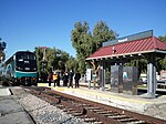
Moorpark station is a passenger rail station in the city of Moorpark, California. Service commenced in 1983 as an infill station on the short-lived CalTrain line. The station was rebuilt in 1992 to accommodate the new Metrolink Ventura County Line commuter trains. Service on that line began on October 26, 1992; Amtrak's Santa Barbara–San Diego San Diegan trains had begun stopping there the day before.Amtrak's Pacific Surfliner from San Luis Obispo to San Diego and Metrolink's Ventura County Line from Los Angeles Union Station to East Ventura stop here. Moorpark station is served by ten Amtrak Pacific Surfliner trains (five in each direction) every day, with departures evenly spaced throughout the day. Sixteen Metrolink Ventura County Line trains (eight in each direction) serve the station each weekday, running during peak hours in the peak direction of travel. On weekends, four Metrolink Ventura County Line trains (two in each direction) serve the station. Metrolink passengers also have access to all Pacific Surfliner trains through a codesharing arrangement with Amtrak.Moorpark served as the Ventura County Line's terminal until service was extended to Oxnard after the Northridge earthquake in 1994, and now acts as the western terminus of the Ventura County Line except during peak hours in the peak direction of travel. Metrolink stores trains in a small yard a short distance west of the station.In FY2018, boarding or detraining Amtrak passengers averaged approximately 50 passengers daily.

Mount Clef Ridge
Mount Clef Ridge

Mount Clef Ridge is a 1,076 ft volcanic mountain in Thousand Oaks, California. It is a volcanic outcrop that resulted from lava eruptions 30 million years ago. The ridge was formerly under ownership by the Janss Corporation, but was acquired by the Conejo Recreation and Park District (CRPD) in 1967. Trails here are available from Santa Rosa Valley, Newbury Park and Wildwood Regional Park. Although being a major feature of Wildwood, it occupies its own open-space area bordering Wildwood's northern boundaries. Mount Clef Ridge Open Space Area occupies 212 acres. From the ridge are great panoramic views of Santa Rosa Valley, Conejo Valley, Hill Canyon, as well as the Santa Susana-, Santa Monica- and Topatopa Mountains. The open-space area is home to plants such as coastal sage scrub, chaparral, Lyon's pentachaeta and Conejo dudleya. The fauna includes mountain lions, deer, coyotes, gray foxes, and more.Mount Clef Ridge was featured in the film Flaming Star (1960) starring Elvis Presley. The horse training scenes in Dark Victory (1939) starring Ronald Reagan also features sequences by the ridge. An army was storming off Mount Clef Ridge in the film Spartacus (1960). The ridge was also featured in Wuthering Heights (1939), where the ridge dubbed for Peniston Crag, England.A rock shelter, known as Wildflower Cave (Ven-486), is located here and was utilized for shelter by the Chumash people in pre-colonial times.The ridge is named in honor of the California Lutheran Education Foundation (CLEF), which worked to establish California Lutheran University in the 1950s.The ridgeline extends from the Norwegian Grade westwards to Wildwood Regional Park. A rock formation that spells out "CLU" can be found atop Mount Clef on the campus of California Lutheran University, and a 30-foot cross is located just east of the landmark letters. The cross was made from old telephone poles. This part of the ridge, Dr. Rudy Edmund Living Laboratory, was dedicated on May 5, 2003, in order to enhance student research in biology and geology at the university. Ecological field studies also take place here. The area's namesake, CLU professor Rudy Edmund, published extensively on the need to preserve Mount Clef Ridge.

California Lutheran University

California Lutheran University (CLU, Cal Lutheran, or Cal Lu) is a private university in Thousand Oaks, California. It was founded in 1959 and is affiliated with the Evangelical Lutheran Church in America, but is nonsectarian. It opened in 1960 as California Lutheran College and was California's first four-year liberal arts college and the first four-year private college in Ventura County. It changed its name to California Lutheran University on January 1, 1986.It is located on a 290-acre (120 ha) campus, 40 miles (64 km) northwest of Los Angeles. It offers degrees at the bachelor's, master's, and doctoral levels, as well as post-master's and post-bachelor's certificates. CLU offers 36 majors and 34 minors. The university is based in Thousand Oaks, with additional locations in Woodland Hills (Los Angeles), Westlake Village, Oxnard, Santa Maria, and Berkeley. Cal Lutheran has been called the West Coast's "Cradle of Coaches"; nearly 1 in 4 of football coach Bob Shoup's players would go on to coach at some level, while 144 players have become football coaches, and several have been drafted to the NFL. Particularly many players were drafted following the NAIA Championship win in 1971. The celebration was held at the Hollywood Palladium in conjunction with the Dallas Cowboys that won their first Super Bowl the following month. In college baseball, 24 student players have been drafted for Major League Baseball as of 2014.