Lezíria do Tejo

The Comunidade Intermunicipal da Lezíria do Tejo (Portuguese pronunciation: [lɨˈziɾia ðu ˈtɛʒu]; English: Tagus Floodplain) is an administrative division in Portugal. It was established as an Associação de Municípios in 1987, converted into a Comunidade Urbana in 2003, and converted into a Comunidade Intermunicipal in November 2008. It is also a NUTS3 subregion of the Alentejo Region. The seat of the intermunicipal community is the city of Santarém. Lezíria do Tejo comprises municipalities of the former districts of Santarém and Lisbon. The population in 2011 was 247,453, in an area of 4,275 square kilometres (1,651 sq mi). In the past, the territory of this administrative division was roughly entirely set in the former historical province of Ribatejo and had nothing to do with the former historical province of Alentejo. Lezíria is the Portuguese word (from the Arabic الجزيرة, al-jazira, "the island") for floodplain or freshwater marsh. Tejo is the name of the main river in the region. The Lezíria is a well-renowned center of intensive farming, horse breeding and animal husbandry.
Excerpt from the Wikipedia article Lezíria do Tejo (License: CC BY-SA 3.0, Authors, Images).Lezíria do Tejo
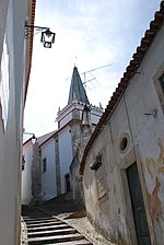
Rua Tenente Valadim, Santarém Santa Iria da Ribeira de Santarém (Cidade de Santarém)
Geographical coordinates (GPS) Address Nearby Places Show on map
Geographical coordinates (GPS)
| Latitude | Longitude |
|---|---|
| N 39.23 ° | E -8.68 ° |
Address
Rua Tenente Valadim
Rua Tenente Valadim
2000-081 Santarém, Santa Iria da Ribeira de Santarém (Cidade de Santarém, Santarém)
Portugal
Open on Google Maps


