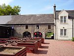
Crofthead railway station

Crofthead railway station or Fauldhouse and Crofthead was a station on the Wilsontown, Morningside and Coltness Railway (WM&CR) that served the area of Crofthead and its miners rows, Greenburn and Gowanbrae near Fauldhouse in West Lothian. The station was located 7 miles 40 chains east of Morningside railway station. The company at first adopted the standard track gauge for mineral lines of 4 ft 6 in, often referred to as Scotch gauge. The Edinburgh and Glasgow Railway took over the WM&CR in 1849, the track gauge already having been changed in August 1847, from the now almost obsolete 4 ft 6 in to the generally accepted standard gauge of 4 ft 8½ in.Crofthead station had at first just a single short platform and this is clearly indicated on the OS map of 1854, It was accessed off Bridge Street near the hamlet of Drybridge, close to Fauldhouse. In 1895 the station site is shown with several buildings, sidings and loading docks in addition to a single platform. The Caledonian Railway (CR) established a goods and mineral depot nearby and Fauldhouse station is also located in the vicinity of the old Fauldhouse and Crofthead station. A number of mineral lines ran from near the station to collieries in the area, Polkemmet Moor, Cult, Rigghouse, etc.The station is also recorded by the North British Railway (NBR) study group as opening on 02/06/1845 and closing under the London and North Eastern Railway (LNER) as Fauldhouse and Crofthead on 1 May 1930.
Excerpt from the Wikipedia article Crofthead railway station (License: CC BY-SA 3.0, Authors, Images).Crofthead railway station
Bridge Street,
Geographical coordinates (GPS) Address Nearby Places Show on map
Geographical coordinates (GPS)
| Latitude | Longitude |
|---|---|
| N 55.8252 ° | E -3.7032 ° |
Address
Bridge Street
Bridge Street
EH47 9AU
Scotland, United Kingdom
Open on Google Maps


