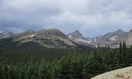
place

Front Range

Mountain ranges of ColoradoRanges of the Rocky Mountains
Indian Peaks Wilderness

The Front Range is a mountain range of the Southern Rocky Mountains of North America located in the central portion of the U.S. State of Colorado, and southeastern portion of the U.S. State of Wyoming. It is the first mountain range encountered as one goes westbound along the 40th parallel north across the Great Plains of North America. The Front Range runs north-south between Casper, Wyoming, and Pueblo, Colorado, and rises nearly 10,000 feet above the Great Plains. Longs Peak, Mount Blue Sky, and Pikes Peak are its most prominent peaks, visible from the Interstate 25 corridor. The area is a popular destination for mountain biking, hiking, climbing, and camping during the warmer months and for skiing and snowboarding during winter. Millions of years ago, the present-day Front Range was home to ancient mountain ranges, deserts, beaches, and even oceans.The name "Front Range" is also applied to the Front Range Urban Corridor, the populated region of Colorado and Wyoming just east of the mountain range and extending from Cheyenne, Wyoming south to Pueblo, Colorado. This urban corridor benefits from the weather-moderating effect of the Front Range mountains, which help block prevailing storms.

Excerpt from the Wikipedia article Front Range (License: CC BY-SA 3.0, Authors, Images).

Front Range
Grays Peak Trail,

Geographical coordinates (GPS) Address Nearby Places
placeShow on map

Wikipedia: Front RangeContinue reading on Wikipedia

Geographical coordinates (GPS)

Latitude Longitude
N 39.633888888889 ° E -105.81694444444 °
placeShow on map

Address

Grays Peak Trail

Grays Peak Trail
80476
Colorado, United States
mapOpen on Google Maps

Indian Peaks Wilderness
Share experience

Nearby Places

Grays Peak Trail
Grays Peak Trail

Grays Peak National Recreation Trail or Grays Peak Trail lies along the Continental Divide of the Americas, part of the Rocky Mountains in the U.S. state of Colorado. It is located in the White River National Forest, Summit County. Grays Peak Trail is south of Interstate 70, east of Keystone Resort and near Montezuma. Grays Peak is adjacent to Torreys Peak. The Grays Peak Trail begins 3 miles above Interstate 70, at 11,200 feet. The summit of Grays Peak is 3.7 miles from the trailhead. Torreys Peak is 4.15 miles from the trailhead, across a saddle from Grays Peak. Grays Peak Trail ascends south through the wetland willows of Stevens Gulch. The trail passes between Stevens Mine on a lower slope of McClellan Mountain, 13,587 feet, forming the eastern wall of the valley, and Sterling Silver Group Mine beside the trail to the right on Kelso Mountain, 13,164 feet. The trail climbs 900 feet during the first 1.7 miles to a National Recreation Trail sign indicating that the summit is two miles farther. From the saddle between Grays and Torreys, Stevens Gulch is within sight. The Keystone Resort slopes of Keystone Mountain, 11,641 feet, North Peak, 11,661, and South Peak, 11,982, are west of Grays Peak. Grays Peak, 14,270 feet, and Mount Edwards, 13,850 feet, form the ridge that is the Continental Divide of the Americas east of Torreys Peak. Wildlife in the area includes mountain goat, pika, cougar or mountain lion, mule deer, elk, marmot, coyote, ptarmigan, American red squirrel, and Canada jay. Wildflowers that bloom in the tundra area on the Continental Divide include moss campion (Silene acaulis), alpine forget-me-not (Myosotis alpestris), sky pilot (Polemonium viscosum), sea pink, old-man-of-the-mountain (Rydbergia grandiflora), and mountain gentian (Gentiana). In the Deer Creek Valley, below the tree-line, the blooms of monkshood or wolfsbane, blue columbine, fireweed, and paintbrush (Castilleja) can be found.

American Discovery Trail

The American Discovery Trail is a system of recreational trails and roads that collectively form a coast-to-coast hiking and biking trail across the mid-tier of the United States. Horses can also be ridden on most of this trail. The coastal trailheads are the Delmarva Peninsula on the Atlantic Ocean and the northern California coast on the Pacific Ocean. The trail has northern and southern alternates for part of its distance, passing through Chicago and St. Louis respectively. The total length of the trail, including both the north and south routes, is 6,800 miles (10,900 km). The northern route covers 4,834 miles (7,780 km) with the southern route covering 5,057 miles (8,138 km). It is the only non-motorized coast-to-coast trail.The trail passes through 14 national parks and 16 national forests and uses sections of or connects to five National Scenic Trails, 10 National Historic Trails, and 23 National Recreation Trails. For part of its distance, it is coincident with the North Country Trail, the Buckeye Trail, the Continental Divide Trail, and the Colorado Trail. The trail passes through the District of Columbia and the following 15 states: Delaware (45 miles (72 km)) Maryland (270 miles (430 km)) West Virginia (288 miles (463 km)) Ohio (524 miles (843 km)) Indiana (250 miles (400 km)) Illinois (219 miles (352 km)) Kentucky (8.7 miles (14.0 km)) Iowa (512 miles (824 km)) Missouri (343 miles (552 km)) Nebraska (523 miles (842 km)) Kansas (570 miles (920 km)) Colorado (1,153 miles (1,856 km)) Utah (593 miles (954 km)) Nevada (496 miles (798 km)) California (276 miles (444 km))