Beverley and Barmston Drain

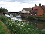
The Beverley and Barmston Drain is the main feature of a land drainage scheme authorised in 1798 to the west of the River Hull in the East Riding of Yorkshire, England. The area consisted of salt marshes to the south and carrs to the north, fed with water from the higher wolds which lay to the north, and from inundation by tidal water passing up the river from the Humber. Some attempts to reduce the flooding by building embankments had been made by the fourteenth century, and windpumps appeared in the seventeenth century. The Holderness Drainage scheme, which protected the area to the east of the river, was completed in 1772, and attention was then given to resolving flooding of the carrs. Embanking the River Hull, and carrying water away from the carrs in a lower level channel was suggested by several engineers, but there was opposition to making the scheme really efficient. Some came from the Holderness Drainage, who insisted that any embankments must ensure that land to the west of the river flooded before their own area was threatened, while an outfall to the Humber was resisted by the Port of Hull, who wanted the water to enter the river to sluice silt from its mouth, known as the Old Harbour. The Beverley and Barmston Drainage Act was finally obtained in 1798, and work began. Water from the north east of the region was diverted to a new sea outfall at Barmston, and 23 miles (37 km) of drainage cuts were constructed, the main channel running broadly parallel to the river, but following a straighter course. Although more efficient than the Holderness scheme, flooding remained a problem, because of the restrictions place on the height of embankments. A route for an outfall to the Humber was blocked by numerous roads and railways, an attempt to dredge the Old Harbour in 1864 proved disastrous, and pumping failed, because the water overtopped the low banks further downstream, and re-entered the drain. However, in 1880, agreement was reached with Holderness Drainage, and a joint scheme of dredging the river and raising the banks on both sides of it ensued. Steam pumping stations at Arram Beck, later replaced by one at Wilfholme, and at Hempholme contributed to the success of the land drainage scheme. More recently, the organisational structure has changed. Henry VIII's Statute of Sewers, dating from 1531, was swept away by the Land Drainage Act 1930, and responsibility passed through six bodies, ending with the Environment Agency in 1995. Local drainage channels were managed by an internal drainage board, and again responsibility has changed as the three IDBs managing the area have gradually merged. Steam pumping was replaced by diesel, and subsequently by electric pumps.
Excerpt from the Wikipedia article Beverley and Barmston Drain (License: CC BY-SA 3.0, Authors, Images).Beverley and Barmston Drain
Brick Bridge, Swinemoor,
Geographical coordinates (GPS) Address Nearby Places Show on map
Geographical coordinates (GPS)
| Latitude | Longitude |
|---|---|
| N 53.8531 ° | E -0.3999 ° |
Address
Brick Bridge, Swinemoor (brickie bridge)
Brick Bridge, Swinemoor
HU17 8DY
England, United Kingdom
Open on Google Maps


