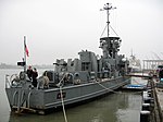
Mare Island
American Civil War army postsIslands of Northern CaliforniaIslands of the San Francisco Bay AreaMare IslandMilitary in the San Francisco Bay Area ... and 3 more
San Pablo BayVague or ambiguous time from February 2011Vallejo, California

Mare Island (Spanish: Isla de la Yegua) is a peninsula in the United States in the city of Vallejo, California, about 23 miles (37 km) northeast of San Francisco. The Napa River forms its eastern side as it enters the Carquinez Strait juncture with the east side of San Pablo Bay. Mare Island is a peninsula, as no full body of water separates this or several other named "islands" from the mainland. Instead, a series of small sloughs cause seasonal water-flows among the so-called islands. Mare Island is the largest of these at about 3.5 miles (5.6 km) long and a mile wide.
Excerpt from the Wikipedia article Mare Island (License: CC BY-SA 3.0, Authors, Images).Mare Island
Crisp Avenue, Vallejo
Geographical coordinates (GPS) Address Nearby Places Show on map
Geographical coordinates (GPS)
| Latitude | Longitude |
|---|---|
| N 38.095254 ° | E -122.278004 ° |
Address
Crisp Avenue 220
94592 Vallejo
California, United States
Open on Google Maps


