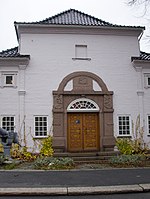
Sandar, Norway
1838 establishments in Norway1968 disestablishments in NorwayFormer municipalities of NorwaySandefjord

Sandar (or historically Sandeherred) is a former municipality in Vestfold county, Norway. The 120-square-kilometre (46 sq mi) municipality existed from 1838 until its dissolution in 1968. The area is now part of Sandefjord Municipality. The administrative centre was located at Sandar, right by the Sandar Church in what is now the town of Sandefjord.Sandar was located in the southern, coastal part of Vestfold county. The European route E18 highway and the Vestfoldbanen railway line both passed through the municipality. The municipality encircled the whole town of Sandefjord until 1968 when they were merged.
Excerpt from the Wikipedia article Sandar, Norway (License: CC BY-SA 3.0, Authors, Images).Sandar, Norway
Storgata, Sandefjord Breidablikk
Geographical coordinates (GPS) Address Nearby Places Show on map
Geographical coordinates (GPS)
| Latitude | Longitude |
|---|---|
| N 59.1343 ° | E 10.2244 ° |
Address
Storgata
3210 Sandefjord, Breidablikk
Norway
Open on Google Maps


