place

Ward No. 2, Kolkata Municipal Corporation

Municipal wards of KolkataUse Indian English from May 2018

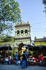
Ward No. 2, Kolkata Municipal Corporation is an administrative division of Kolkata Municipal Corporation in Borough No. 1, covering parts of Sinthee (Ramlila Bagan-Biswanath Colony-Roypara), Sobji Bagan and Satpukur neighbourhoods in North Kolkata, in the Indian state of West Bengal.

Excerpt from the Wikipedia article Ward No. 2, Kolkata Municipal Corporation (License: CC BY-SA 3.0, Authors).

Ward No. 2, Kolkata Municipal Corporation
Kolkata Cossipore (Kolkata District)

Geographical coordinates (GPS) Address Nearby Places
placeShow on map

Wikipedia: Ward No. 2, Kolkata Municipal CorporationContinue reading on Wikipedia

Geographical coordinates (GPS)

Latitude Longitude
N 22.628056 ° E 88.384444 °
placeShow on map

Address


700050 Kolkata, Cossipore (Kolkata District)
West Bengal, India
mapOpen on Google Maps

Share experience

Nearby Places

Kolkata Metro Line 1

The Line 1, Blue Line, also known as North–South Metro of the Kolkata Metro, is a rapid transit system serving South 24 Parganas, Kolkata and North 24 Parganas in Indian state of West Bengal. It consists of 26 operational stations from Dakshineswar to Kavi Subhash, of which 9 are elevated, 2 are at grade and the remaining 15 are underground with a total distance of 31.3 km (19.4 mi). The line connects Dakshineswar and New Garia and uses 5 ft 6 in (1,676 mm) 5 ft 6 in (1,676 mm) broad gauge rolling stock. Dakshineswar was opened on 22 February 2021 is an elevated station located 4.1 km (2.5 mi) north of Noapara . It was the first underground railway to be built in India, with the first operations commencing in October 1984 and the full stretch that was initially planned being operational by February 1995. On 28 December 2010, it became the 17th zone of the Indian Railways. Being the country's first, and a completely indigenous process, the construction of the Kolkata Metro was more of a trial-and-error affair, in contrast to the Delhi Metro, which has seen the involvement of numerous international consultants. As a result, it took nearly 23 years to completely construct around 15 km (9.3 mi) underground railway from Birpara up to Tollygunge Metro Station. Public transport experts have suggested that the line be extended from Dakshineswar to Bally (where it can connect with local trains of the Howrah division of Eastern Railway) and eventually to Dankuni, an emerging industrial city.