place

Red Spring Run

Rivers of Luzerne County, PennsylvaniaRivers of PennsylvaniaTributaries of the Lackawanna River

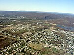
Red Spring Run (also known as Red Springs Run) is a tributary of the Lackawanna River in Lackawanna County and Luzerne County, in Pennsylvania in the United States. It is approximately 1.5 miles (2.4 km) long and flows through Ransom Township in Lackawanna County and Duryea in Luzerne County. The watershed of the stream has an area of 1.25 square miles (3.2 km2). It is designated as a Coldwater Fishery and a Migratory Fishery. The stream has one unnamed tributary. Many reaches of the stream have been affected by mining and abandoned mines. The surficial geology in its vicinity features alluvium, coal dumps, surface mining land, and Wisconsinan Till.

Excerpt from the Wikipedia article Red Spring Run (License: CC BY-SA 3.0, Authors).

Red Spring Run
Coxton Road,

Geographical coordinates (GPS) Address Nearby Places
placeShow on map

Wikipedia: Red Spring RunContinue reading on Wikipedia

Geographical coordinates (GPS)

Latitude Longitude
N 41.3558 ° E -75.7655 °
placeShow on map

Address

Coxton Road

Coxton Road
18642
Pennsylvania, United States
mapOpen on Google Maps

Share experience

Nearby Places

Spring Brook (Lackawanna River tributary)

Spring Brook (also known as Spring Brook Creek) is a tributary of the Lackawanna River in Lackawanna County and Luzerne County, in Pennsylvania, in the United States. It is approximately 17 miles (27 km) long and flows through Covington Township, Spring Brook Township, and Moosic in Lackawanna County and Pittston Township in Luzerne County. The watershed of the stream has an area of 57.2 square miles (148 km2). It is designated as a High-Quality Coldwater Fishery and a Migratory Fishery above Interstate 476 and as a Coldwater Fishery and a Migratory Fishery below it. A section is also designated as Class A Wild Trout Waters. The stream's tributaries include Panther Creek, Plank Bridge Creek, Rattlesnake Creek, Green Run, Monument Creek, and Covey Swamp Creek. It has a relatively high level of water quality and is very slightly acidic, with a pH of 6.4 to 6.9. The upper reaches of the watershed of Spring Brook are mountainous and swampy. Further downstream, the stream flows through a water gap in the Moosic Mountains. Sandstone, shale, and some coal are present in the vicinity of the stream. It has been channelized in a concrete channel for part of its length and is the main source of flooding in Spring Brook Township, Lackawanna County. The stream is the second-largest tributary of the Lackawanna River. Reservoirs on Spring Brook include the Spring Brook Intake, the Nesbitt Reservoir, the Watres Reservoir. There are three dams on the stream. The watershed is mainly forested, with only a small amount of urban land. In the past, industries in the watershed of Spring Brook included timbering, coal mining, and agriculture. Two railroads also passed through the watershed in the early 1900s, at least one of which was established by the 1880s. The stream's watershed has served as a water supply since at least the early 1900s and still serves as a water supply for the Lackawanna Valley. Several bridges have also been constructed across the stream in the 20th century. The stream has been part of several studies since 1970. Part of its length is navigable by kayaking, paddling, and rafting.

Lackawanna River
Lackawanna River

The Lackawanna River is a 42-mile-long (68 km) tributary of the Susquehanna River in Northeastern Pennsylvania. It flows through a region of the northern Pocono Mountains that was once a center of anthracite coal mining in the United States. It starts in north Wayne County, Pennsylvania and ends in east Luzerne County, Pennsylvania in Duryea, Pennsylvania. The lower reaches of the river flow through the urban areas of Scranton, which grew around its banks in the 19th century as an industrial center. Its name comes from a Lenape word meaning "stream that forks".The river rises in two branches, the West and East branches, along the boundary between Susquehanna and Wayne counties. The branches, each about 12 miles (19 km) long, flow south, closely parallel to each other, and join at the Stillwater Lake reservoir in Union Dale. The combined river flows southwest past Forest City, Carbondale, Mayfield, Jermyn, Archbald, Jessup, Blakely, Olyphant, Dickson City, Throop, Scranton, Taylor, Moosic, Old Forge, and Duryea. It joins the Susquehanna River at the northern boundary of Pittston about 8 miles (13 km) west-southwest of Scranton. As part of the Susquehanna River, it ultimately flows to Chesapeake Bay. By the mid-20th century, the river was severely polluted from mine drainages in its watershed. The decline of industry in the region, as well as federal, state, and private efforts, have improved the water quality. Still, the Lackawanna River is the largest point source of pollution in the Chesapeake Bay. The upper reaches of the river are a popular destination for fly fishing of trout. It was designated as an American Heritage River in 1997.