Qualicum National Wildlife Area

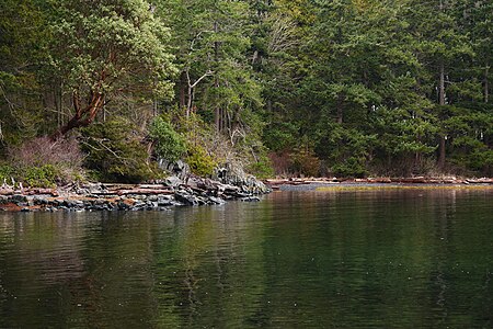
The Qualicum National Wildlife Area (NWA) was officially established in 1977, under the Canada Wildlife Act (1973). The primary objective of the Qualicum NWA was to conserve crucial habitats for migratory birds and various other species.The national wildlife area consists of three small units - Rosewall Creek, Marshall-Stevenson, and Nanoose Bay - spread out along the northeastern coast Vancouver Island between the communities of Fanny Bay and Nanoose Bay. Since it is a National Wildlife Area (NWA), Qualicum NWA is governed by the Canada Wildlife Act and managed by the Canadian government department Environment and Climate Change Canada. While most National Wildlife Areas are closed to the public to reduce the human impacts on the land, vegetation, animals, and insects, the Qualicum NWA is open for certain recreational activities, such as wildlife viewing and hiking as well as hunting in certain areas.
Excerpt from the Wikipedia article Qualicum National Wildlife Area (License: CC BY-SA 3.0, Authors, Images).Qualicum National Wildlife Area
Surfside Drive, Area G (Mid-Oceanside)
Geographical coordinates (GPS) Address Nearby Places Show on map
Geographical coordinates (GPS)
| Latitude | Longitude |
|---|---|
| N 49.366666666667 ° | E -124.49166666667 ° |
Address
Surfside Drive
Surfside Drive
V9K 2B7 Area G (Mid-Oceanside)
British Columbia, Canada
Open on Google Maps


