Nain, South Australia
South Australia geography stubsTowns in South AustraliaUse Australian English from August 2019

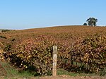
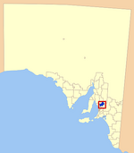
Nain is a settlement west of Greenock in the northern Barossa Valley region of South Australia. It was first settled in the 1850s, mostly by German settlers moving from the Mount Barker area. The Nain "Zum Schmalen Wege" church operated from 1861 to 1893, and the present Nain church opened in 1856. Both have cemeteries.
Excerpt from the Wikipedia article Nain, South Australia (License: CC BY-SA 3.0, Authors, Images).Nain, South Australia
Nain Road, Light Regional Council
Geographical coordinates (GPS) Address Nearby Places Show on map
Geographical coordinates (GPS)
| Latitude | Longitude |
|---|---|
| N -34.4497 ° | E 138.9004 ° |
Address
Nain Road
5360 Light Regional Council
South Australia, Australia
Open on Google Maps


