Dollberg
Mountains and hills of Rhineland-PalatinateMountains and hills of the SaarlandMountains under 1000 metresSankt Wendel (district)Trier-Saarburg

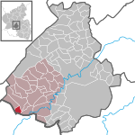
The Dollberg is a mountain in the Dollberge range in central Germany and the highest point in the state of Saarland. It is 695.4 m above sea level (NHN) and lies within the Schwarzwälder Hochwald on the boundary between the counties of Trier-Saarburg (Rhineland-Palatinate) and St. Wendel (Saarland).
Excerpt from the Wikipedia article Dollberg (License: CC BY-SA 3.0, Authors, Images).Dollberg
Hunnenringweg,
Geographical coordinates (GPS) Address Nearby Places Show on map
Geographical coordinates (GPS)
| Latitude | Longitude |
|---|---|
| N 49.62972 ° | E 7.014444 ° |
Address
Dollberg
Hunnenringweg
66620 (Otzenhausen)
Saarland, Germany
Open on Google Maps


