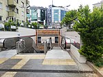
Esatpaşa, Ataşehir
Istanbul Province geography stubsNeighbourhoods of Ataşehir
Esatpaşa is a neighbourhood in the municipality and district of Ataşehir, Istanbul Province, Turkey. Its population is 33,123 (2022). It is on the Asian side of Istanbul. It is bounded on the north by the Cumhuriyet neighborhood of Üsküdar, on the east by the Aşık Veysel neighborhood of Ataşehir, on the south and west by the Örnek neighborhood of Ataşehir, and on the west by the Fetih neighborhood of Ataşehir. The neighborhood is in the location of the former Esatpaşa Çiftliği (Esatpaşa Farm), which was named for Esat Paşa, an Ottoman general.The neighborhood was organized in 1969 and includes three high schools, two primary schools, three mosques, and ten parks.
Excerpt from the Wikipedia article Esatpaşa, Ataşehir (License: CC BY-SA 3.0, Authors).Esatpaşa, Ataşehir
Ziya Paşa Caddesi,
Geographical coordinates (GPS) Address Nearby Places Show on map
Geographical coordinates (GPS)
| Latitude | Longitude |
|---|---|
| N 41.0035 ° | E 29.0851 ° |
Address
dilan market
Ziya Paşa Caddesi
34704 , Esatpaşa Mahallesi
Turkey
Open on Google Maps


