place

Zlatnica

Banská Bystrica Region geography stubsGeography of Banská Bystrica RegionProtected areas of Slovakia
Zlatnica Nature reserve

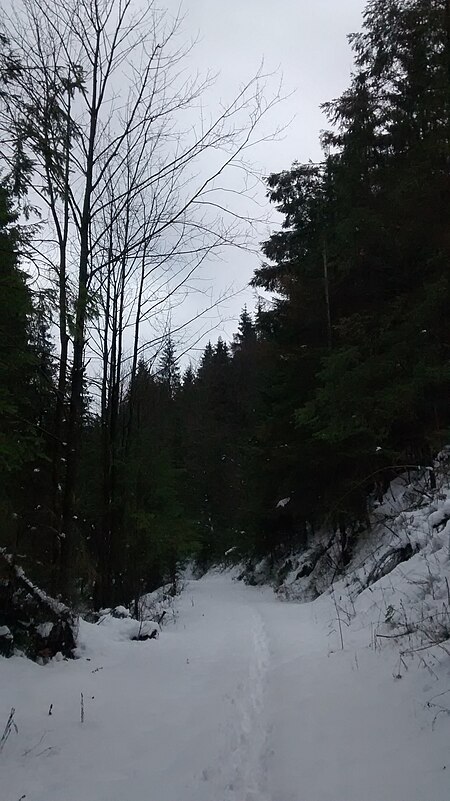
Zlatnica is a valley and nature reserve in the Slovak county of Brezno in the municipality of Šumiac. It covers an area of 154.00 ha and has a protection level of 5 under the slovak law which corresponds with the IUCN level Ib. It is part of the Muránska planina National Park.

Excerpt from the Wikipedia article Zlatnica (License: CC BY-SA 3.0, Authors, Images).

Geographical coordinates (GPS)

Latitude Longitude
N 48.8192 ° E 20.1044 °
placeShow on map

Address

Sviniarková


976 71 (Šumiac)
Region of Banská Bystrica, Slovakia
mapOpen on Google Maps

Zlatnica Nature reserve
Share experience

Nearby Places

Kráľova hoľa
Kráľova hoľa

Kráľova hoľa (Slovak pronunciation: [ˈkraːʎɔʋa ˈɦɔʎa]; German: Königsberg; Hungarian: Király-hegy, literally "King's Mountain") is the highest mountain (1,946 m) of the eastern part of the Low Tatras in central Slovakia. Four rivers rise at its foot: Čierny Váh, Hnilec, Hornád, and Hron. The summit, easily accessible by hiking trails from Telgárt as well as by a paved road from Šumiac (not open to motor vehicles, except for the mountain rescue service and maintenance workers of the TV transmitter on the summit), offers a panoramic view of Spiš, the Tatras, Liptov, and the Upper Hron Valley. Largely deforested by exploitative timber harvesting in the early 19th century, its timberline was restored to its natural elevation of about 1,650 m (5,413 ft.) through the efforts of Ludwig Greiner in the second half of that century.Kráľova hoľa is often depicted in Slovak folklore and Romantic poetry as a safe refuge of heroes and highwaymen, in particular Juraj Jánošík. As a metaphor of homeland in folk ballads (such as Na Kráľovej holi) and particularly in one of the best-known Slovak poems The Death of Jánošík (1862) by Ján Botto, the mountain has become one of the informal Slovak national symbols along with Kriváň. During the anti-Nazi Slovak National Uprising, the partisan group Jánošík had their shelters below the top of the mountain. In 1960, a TV transmitter with a 137.5 metres tall guyed tubular mast was built on the top. There is also a weather station and a station of the mountain rescue service.

Muráň Castle
Muráň Castle

Muráň Castle (Slovak: Muránsky hrad; Hungarian: Murány vára), is a ruin of a medieval castle above the village of Muráň, in the Muránska planina National Park in Slovakia. The castle is noteworthy for its unusually high elevation of 935 m, making it the third highest castle in Slovakia. It also figures in several romantic legends about its owners. Murány Castle was built in the 13th century on a cliff overlooking a regional trade route. Its name was mentioned for the first time in 1271 ("arx Mwran"), when Stephen V of Hungary ceded the castle to Gunig comes. One of its owners, the robber baron Mátyás Basó (or Bacsó, in Slovak: Matúš Bašo), transformed the castle into a stronghold of bandits who robbed merchants and looted villages. After a siege by the royal army, the castle fell in 1548 and Basó was executed. One of the oldest Slovak songs, "The Song About The Castle of Muráň", written by Martin Bošňák describes this battle. Another owner was Mária Széchy, better known as "The Venus of Murány". This independent woman divorced her second husband to marry the love of her life, magnate Ferenc Wesselényi, the subsequent Palatine of Hungary. When Wesselényi was besieging Murány Castle, which was occupied by her relatives at the time, she managed to get his soldiers inside through trickery. In 1666, Wesselényi organized a failed coup against Leopold I, but he died before any major confrontation. Subsequently, Mária Széchy bravely led a defense of the castle against imperial troops. Outnumbered, she eventually surrendered to Charles of Lorraine in 1670. After the Treaty of Szatmár, the importance of the castle declined, as did its general condition. It was damaged twice in the 18th century by fire, in 1702 and in 1760.The area was part of Gömör, then Gömör és Kishont County of Hungary. In 1920, under the terms of the Treaty of Trianon it became part of the newly formed Czechoslovakia.