place

Municipal Borough of Bebington

Cheshire geography stubsFormer districts of CheshireHistory of CheshireHistory of MerseysideLocal government in the Metropolitan Borough of Wirral
Merseyside geography stubsMunicipal boroughs of EnglandUse British English from September 2020
Municipal Borough of Bebington, Cheshire (1970)

Bebington was a local government district on the Wirral Peninsula, in Cheshire, England. It was the local authority for the towns of Bebington and Bromborough. New Ferry and Port Sunlight were also within its boundaries. The district also included the civil parishes of Brimstage, Eastham, Poulton cum Spital, Raby, Storeton and Thornton Hough.Created in 1922 as an urban district, it absorbed Bromborough Urban District, Higher Bebington Urban District and Lower Bebington Urban District. The new jurisdiction was known as Bebington and Bromborough Urban District. Its name was changed to Bebington Urban District in 1933, shortly before being incorporated as a municipal borough in 1937.The coat of arms of Bebington were granted on 3 January 1934. The shield featured two wheatsheaves, an emblem of the county of Cheshire and a ship to represents the borough's proximity to the River Mersey and the Manchester Ship Canal. The saltire of St. Andrew in the upper-centre, depicts to whom Bebington parish church is dedicated. Bromborough Cross is featured at the top of the crest.On 1 April 1974, under the Local Government Act 1972, the municipal borough was abolished and its area absorbed into the Metropolitan Borough of Wirral, in the metropolitan county of Merseyside.

Excerpt from the Wikipedia article Municipal Borough of Bebington (License: CC BY-SA 3.0, Authors, Images).

Municipal Borough of Bebington
Church Road, Wirral

Geographical coordinates (GPS) Address Nearby Places
placeShow on map

Wikipedia: Municipal Borough of BebingtonContinue reading on Wikipedia

Geographical coordinates (GPS)

Latitude Longitude
N 53.35 ° E -3.003 °
placeShow on map

Address

Church Road

Church Road
CH63 7TD Wirral, Lower Bebington
England, United Kingdom
mapOpen on Google Maps

Municipal Borough of Bebington, Cheshire (1970)
Share experience

Nearby Places

Bebington
Bebington

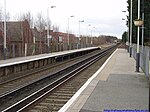
Bebington () is a town and unparished area within the Metropolitan Borough of Wirral, in Merseyside, England. Historically part of Cheshire, it lies 5 miles (8 km) south of Liverpool, close to the River Mersey on the eastern side of the Wirral Peninsula. Nearby towns include Birkenhead and Wallasey to the north-northwest, and Heswall to the west-southwest. Bebington railway station opened in 1838 and is situated on the Wirral line of the Merseyrail network. The electoral ward, which includes the original village centres of Higher Bebington and Lower Bebington, had a total resident population of 13,720 at the 2001 census. which increased to 15,768 at the 2011 census. Some definitions of Bebington include adjoining areas such as Port Sunlight (an early planned factory town), New Ferry, Spital and Storeton. The former Municipal Borough of Bebington, a local authority between 1937 and 1974, also included within its boundaries Bromborough, Eastham, Raby, Thornton Hough and Brimstage, which now fall within the electoral wards of Bromborough, Eastham and Clatterbridge. Bebington forms part of the wider Birkenhead urban area, which had a population of 325,264 in 2011.According to a 2015 study commissioned by Royal Mail from the Centre for Economic and Business Research, Bebington's postcode area, CH63, is the most desirable in England in which to live and work. The study found that the area had "the ideal balance" of housing close to places of work, good schools and high employment.