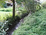
Staufenberg, Lower Saxony
Göttingen (district)Göttingen district geography stubsMunicipalities in Lower Saxony

Staufenberg is the southernmost municipality of the district of Göttingen, and of Lower Saxony, Germany. It is situated east of the river Fulda, approx. 6 km south of Hannoversch Münden, and 12 km northeast of Kassel. Its seat is in the village Landwehrhagen.
Excerpt from the Wikipedia article Staufenberg, Lower Saxony (License: CC BY-SA 3.0, Authors, Images).Staufenberg, Lower Saxony
Fuhrweg, Staufenberg
Geographical coordinates (GPS) Address Nearby Places Show on map
Geographical coordinates (GPS)
| Latitude | Longitude |
|---|---|
| N 51.35 ° | E 9.5997222222222 ° |
Address
Fuhrweg
Fuhrweg
34355 Staufenberg
Lower Saxony, Germany
Open on Google Maps


