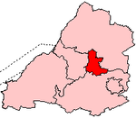
Kingswood, South Gloucestershire

Kingswood is a suburban town and unparished area in the South Gloucestershire district, in the ceremonial county of Gloucestershire, England, bordering the eastern edge of the City of Bristol. The suburb is situated 3.4 miles (5.5 km) east-northeast of Bristol city centre and 102 miles (164 km) west of London.Broadly speaking, Kingswood spans the area from John Cabot Academy in the west to the A4174 ring road in the east. Some areas which are in close proximity to Kingswood, such as Two Mile Hill and St George East (both located within the City of Bristol) and parts of Hanham and Warmley Hill are often considered to be part of Kingswood by locals. The border between South Gloucestershire and the City of Bristol is situated at the western end of Kingswood's High Street. Although anything beyond this point is technically no longer Kingswood 'proper', locals often consider the shops and residential areas that fringe the road named 'Two Mile Hill' (located within the area of the same name) to be a continuation of Kingswood. In 2011 it had a population of 40,734.
Excerpt from the Wikipedia article Kingswood, South Gloucestershire (License: CC BY-SA 3.0, Authors, Images).Kingswood, South Gloucestershire
Orchard Corner,
Geographical coordinates (GPS) Address Nearby Places Show on map
Geographical coordinates (GPS)
| Latitude | Longitude |
|---|---|
| N 51.46 ° | E -2.505 ° |
Address
Orchard Corner 14
BS15 9AD
England, United Kingdom
Open on Google Maps


