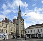
North Wiltshire
North Wiltshire was a local government district in Wiltshire, England, between 1974 and 2009, when it was superseded by Wiltshire Council. The district was formed on 1 April 1974 by a merger of the municipal boroughs of Calne, Chippenham, and Malmesbury along with Calne and Chippenham Rural District, Cricklade and Wootton Bassett Rural District and Malmesbury Rural District. It shared its name with the North Wiltshire parliamentary constituency, the boundaries of which were coterminous with that of the district until 1997. The new body's headquarters were in central Chippenham at Bewley House, a large office block which had been built in 1967 for Calne and Chippenham Rural District Council. They later moved to newly built offices at Monkton Park, another site in the town centre, overlooking the River Avon.The district was abolished on 1 April 2009 as part of the structural changes to local government in England, when its functions were taken over by the new Wiltshire Council unitary authority.
Excerpt from the Wikipedia article North Wiltshire (License: CC BY-SA 3.0, Authors).North Wiltshire
Ivy Lane,
Geographical coordinates (GPS) Address Nearby Places Show on map
Geographical coordinates (GPS)
| Latitude | Longitude |
|---|---|
| N 51.461 ° | E -2.119 ° |
Address
Chippenham Viaduct
Ivy Lane
SN15 1JU
England, United Kingdom
Open on Google Maps


