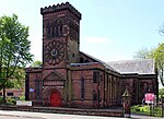
place

South Liverpool F.C. (1890s)

1890s establishments in EnglandAssociation football clubs disestablished in 1921Association football clubs established in 1897Defunct football clubs in EnglandDefunct football clubs in Merseyside
Lancashire CombinationLancashire League (football)The Combination

South Liverpool F.C. was a football club from Liverpool, England. The club's colours were white shirts, black shorts and red socks. The club relocated and became New Brighton A.F.C. in 1921. In 1935 a phoenix club was established South Liverpool F.C. (1935).

Excerpt from the Wikipedia article South Liverpool F.C. (1890s) (License: CC BY-SA 3.0, Authors).

South Liverpool F.C. (1890s)
Jericho Lane, Liverpool Aigburth

Geographical coordinates (GPS) Address Nearby Places
placeShow on map

Wikipedia: South Liverpool F.C. (1890s)Continue reading on Wikipedia

Geographical coordinates (GPS)

Latitude Longitude
N 53.367811111111 ° E -2.9388083333333 °
placeShow on map

Address

Jericho Lane

Jericho Lane
L17 5AL Liverpool, Aigburth
England, United Kingdom
mapOpen on Google Maps

Share experience

Nearby Places

River Jordan, Liverpool

The River Jordan, Little Jordan or Otterspool Brook is a tributary of the River Mersey. It has now been culverted for most of the lower part of its course, which runs through Otterspool Park in Aigburth, Liverpool. The river had two tributaries, the Upper and Lower Brooks. The Upper Brook rose near the playing fields in Wavertree, flowing past, and inspiring the name of, the Brook House pub. The Lower Brook had a source in Wavertree Botanic Gardens, where it rose in two ponds near Edge Lane; both branches joined in present-day Sefton Park before flowing through a series of natural cascades into the Otterspool, a creek on the Mersey shore. The watercourse was recorded in the 13th century Chartulary of Whalley Abbey as the "Oskelesbrok", when it was described as forming the boundary of Toxteth, and flowing into "Oterpol". The name, also written as "Haskelesbroc" and "Hoskellesbrok" in the period, may contain a reference to the Old Norse personal name Askell. The brook later gained the name of the "River Jordan", probably during the 17th century when Toxteth Park was disparked and let as farmland. The first tenants were Puritan in religion and this has been suggested as the origin of the name "Jordan", as well as that of a nearby farm called "Jericho" and a rock called "David's Throne". Otterspool itself was one of the most important of the Mersey fisheries well into the 18th century, and was reputed to be the finest salmon fishery in the area. The course of the river was changed radically in the 19th century, when housing developments and parks were laid out and much of the watercourse was incorporated into a series of ornamental water features. The Upper Brook was dammed in Greenbank Park to form a lake, and both it and the Lower Brook were channelled into the Boating Lake in Sefton Park. Below this point, the river is currently visible near the gates of Otterspool Park but has been culverted from that point, though many features of its valley are still visible in the park. The area of the river mouth is now part of the Otterspool Promenade, where the river's flow is now piped to the Mersey.

Otterspool Promenade

Otterspool Promenade is a riverside walk and accompanying area of parkland in the Aigburth and Grassendale districts of Liverpool, England. The promenade runs along the bank of the River Mersey from just north of Garston Docks to Otterspool Park. A narrower footpath and cycling lane continue north along the riverbank to the city centre, ending at the Albert Dock. The promenade adjoins the former private parkland estates of Cressington Park, Fulwood Park and Grassendale Park. It is notable for the excellent views it gives of shipping in the Mersey and over the river to the Wirral. Opened in 1950, it was built by landscaping a site that had been used for disposal of household waste, and for spoil from excavation of the Queensway tunnel under the Mersey in the 1920s. The stated desire of the local authorities was, "Firstly... provide a place where the citizens of Liverpool can enjoy their leisure in pleasant surroundings on the banks of the Mersey estuary. Secondly... for providing a large area where the essential need to the community for the disposal of its refuse could be met economically and by the use of hygienic and up-to-date methods." Renovations of the promenade were undertaken in 2006 and 2007, including the creation of a children's playground. The renovations were opened in 2007 with a plaque commemorating Liverpool's 800th anniversary. After several years of campaigning by skateboarders, rollerbladers, and BMXers, the promenade had a concrete skate park installed, which was completed in May 2015. To the north of the promenade on the riverbank was the 1984 International Garden Festival site.